
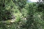
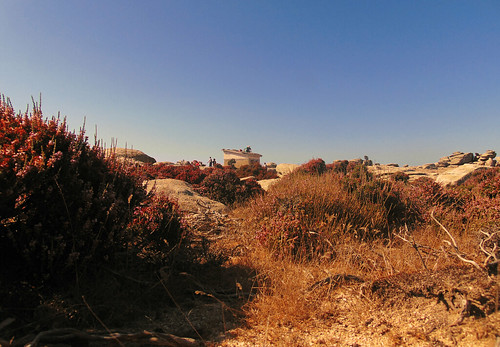
Natural pools and Swimming holes in Ikaria ☺️
Δημοσιεύθηκε: 11 Ιουλίου, 2023 Filed under: choses vécues, exploring, hiking, ikaria, pleasure, Uncategorized | Tags: adventure, aegean, angels' pools, blog review, enviro-lore, explorers, freedom, Google maps, Greece, hiking trails, χάρτης, Ικαρία, αγγελολιβάδες, μονοπάτια, map, nakedness, natural pools, vathres, waters, wild swimming 10 Σχόλια.
Hello readers! ☺️
This is actually a long promised reblog of a popular article written by my dear friend Nana in June 2016. However, while the photos are on topic, the article itself is more abstract than you would expect judging from a title like «Swimming Holes in Ikaria». Because Nana, after some brainstorming on things that she eventually didn’t write about, decides to talk about wild swimming but only about the theory behind the activity. Everybody yells «Come on, give us the spots!» but no, Nana feels that people should first, before and above everything, understand the concept!
Well, that’s my friend! That’s why I love her! ❤️
So she goes and finds a famous book on the culture of wild swimming in natural settings worldwide and she translates in Greek several passages. I think it’s worth to visit her article and read them.
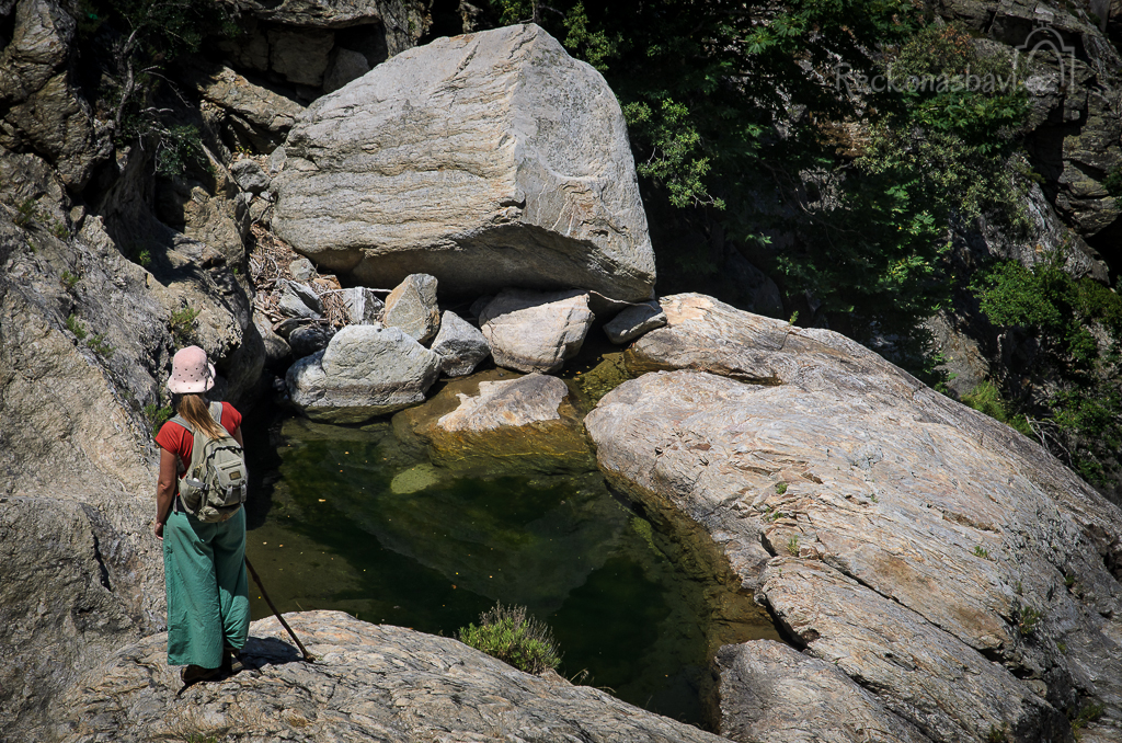
But hey! That wasn’t the reason I am rebloging! The reason is that seven years after that post, that is six days ago, a friend appeared with an amazing detailed map of all known and unknown natural pools and swimming holes of Ikaria!
Isn’t that wonderful! ❤️ ☺️
Now I’m shutting my big mouth and saying no more. I’ll just embed the map and copy below its introductory note. If you are not familiar with Google maps, you should know that there are descriptions, directions and photos inside each pin and that map contains about forty! Worth checking them out – even out of curiocity, just to admire the size of the work!
Inspired and motivated by an old aritcle in Greek by my friend Nana I have added some pins on the map of Ikaria on Google to indicate the best natural river pools of the island for enjoying nature, swimming or just chilling. Don’t take this map too seriously. It’s only a trivial attempt. 😉
🔴 Beware: not all of these locations are easily accessible and it’s not always certain that there will be water there as late as midsummer.
🔴 Don’t hold me responsible for any injuries while searching for these locations. We are talking about a very rough terrain and calculating distances and times while wandering inside these ravines can be very tricky.
🔴 Don’t get involved into these adventures alone and without a reliable smartphone with good connection and GPS facility.
🔴 I also suggest you carry a map of the island. I recommend the new hiking map of ANAVASSI Editions available also in digital form.
🔴 English edition: https://anavasi.gr/Ikaria-map-eng
🔴 Greek edition: https://anavasi.gr/Ikaria-chartis-gr
🚯 DO NOT LITTER
🧴 DO NOT POLLUTE
⛺ DO NOT OCCUPY
🔥 DO NOT LIGHT FIRE
In case of emergency:
Fire Station and Rescue Team in Agios Kirikos: TEL 2275022784
Fire Station and Rescue Team in Rahes: TEL 2275041045
Thanks ‘Love Ikaria’!
That’s all from me this summer!
Be active, be safe and enjoy!.
💗 💗 💗
Eleni Ik.
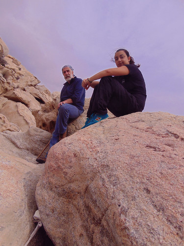
. From an original on Instagram © All rights reserved


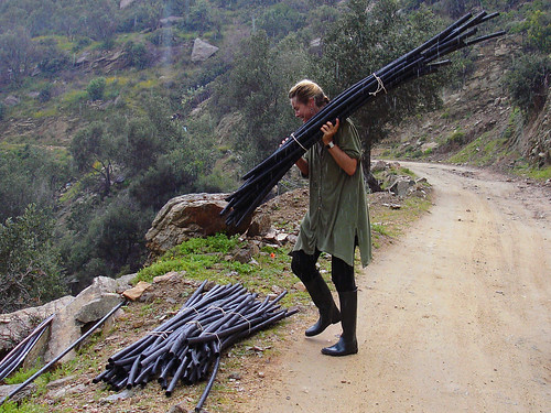
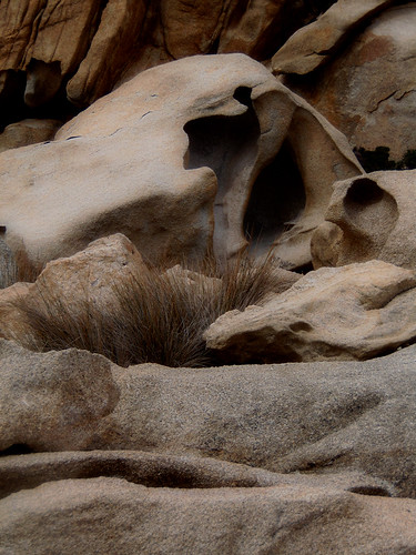
 Helping Hands by Steve Stavropoulos on Flickr © All rights reserved
 From an original on Instagram © All rights reserved
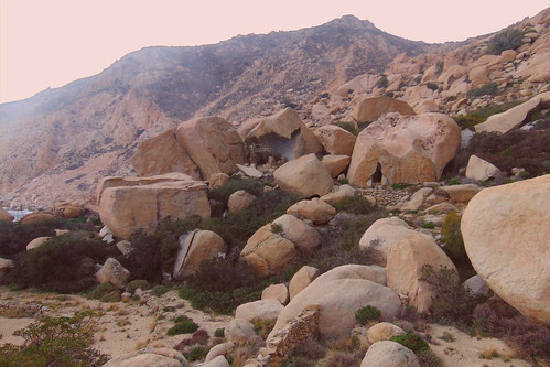


![Natural pools and Swimming holes in Ikaria, a map on Google maps by Love Ikaria [Header Image opens to map]](https://live.staticflickr.com/8482/29361360700_5637aec1ba.jpg?w=500)
Γύρισα από τη Λέσβο πολύ κουρασμένη όπως και τις προηγούμενες φορές και ευτυχώς εδώ τα βρήκα όλα ήρεμα και πολύ αγροτικά. Παρόλα αυτά είμαι ακόμα ταραγμένη γι’ αυτό σκεφτόμουν π.χ. να γράψω για θέματα αρχαία και αλλόκοτα όπως α
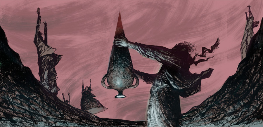 ς πούμε τα ΑΝΕΜΟΤΑΦΙΑ ΤΗΣ ΙΚΑΡΙΑΣ που ήταν ένα μαγικό εθιμικό που έθαβαν τους ανέμους που έκαναν ζημιές και που γι’ αυτό το
 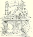 εθιμικό βρήκα εδώ ένα καταπληκτικό καρτούν.
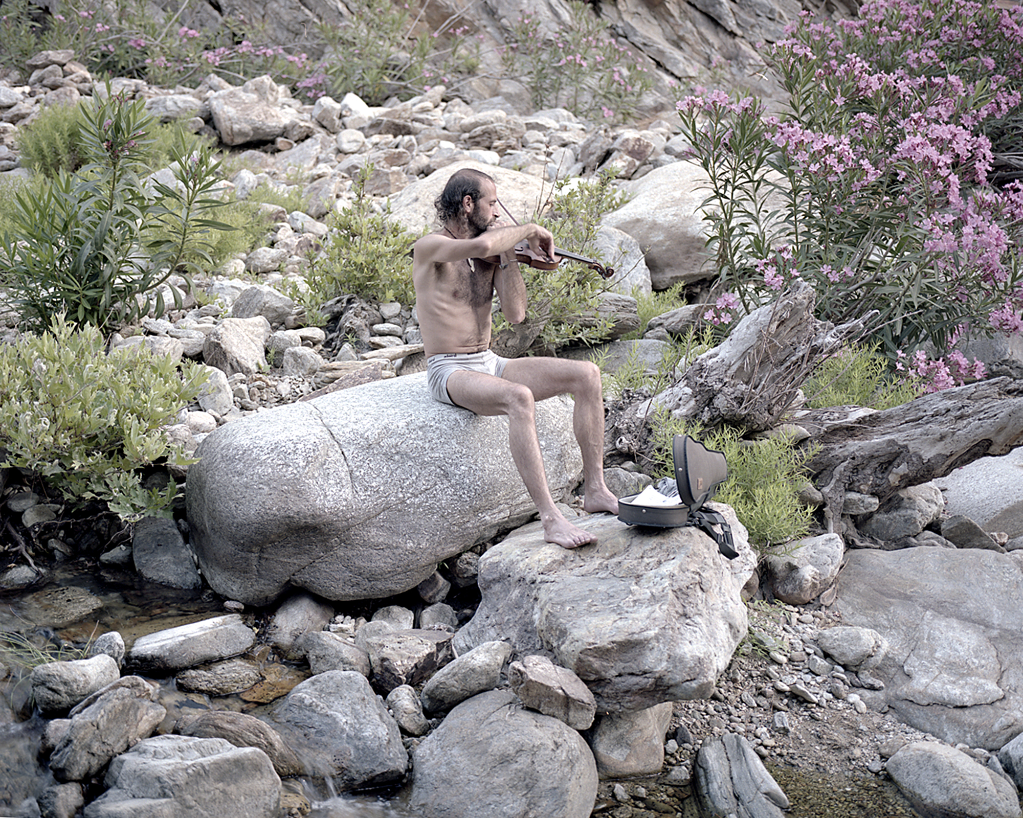 ‘Η να έγραφα για κάτι πιο σημερινό, π.χ. τους ρομαντικούς «αγριάνθρωπους» που πότε-πότε συναντά κανείς στην Ικαρία όπως τους φωτογράφησε και έγραψε γι’ αυτούς ένας που το έψαξε το θέμα…
Δείτε την αρχική δημοσίευση 755 επιπλέον λέξεις
The Round of Rahes on Foot 👣
Δημοσιεύθηκε: 8 Μαΐου, 2020 Filed under: choses vécues, exploring, hiking, holidays, ikaria, pleasure, travel, Uncategorized | Tags: aegean, covid-19, Google maps, Greece, greeks-in-crisis, hiking map, hiking trails, ikaria, χάρτης μονοπατιών, Ικαρία, Ο Γύρος των Ραχών με τα Πόδια, μονοπάτια, Mountain Climbing and Hiking Association of Ikaria, OPS Ikarias, self-guided hiking, The Round of Rahes on Foot, tourism 11 Σχόλια.
Dear readers
As our lockdown in Greece was about to end last week the boys were listening to the Greek Deputy Minister for Sports, Lefteris Avgenakis on TV. He was saying that due to the health crisis all major sports events (read, football) are cancelled. The boys were very sad over this so I turned and paid attention. The Minister of Great God Football concluded his announcement with these words:
«It is certain that the crisis of the pandemic we are experiencing has created opportunities. This fact makes us very happy. We continue in the direction of promoting our health and I invite you to look for forms of alternative sports and to discover the joy of these activities and the endless beauty of our country».
I was really startled! I had never expected a Sports Minister of a Mediterranean country to suggest hiking instead of football!
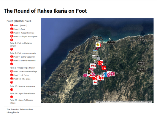
Consequently, I see myself as perfectly complying with the government request as I am writing this article about hiking. It is, of course, about hiking in Ikaria and in particular, about hiking on one of the oldest and best hiking trails on my island, the «The Round of Rahes on Foot», a natural and cultural heritage trail created about 20 years ago which was just recently worked afresh by the members of the local hiking club OPS Ikarias.
This famed hike starts very near Armenistis. This village is the main tourist town of the island, therefore the Round, unlike the other distant hikes on the mountains, was designed as an easy self-guided sightseeing walk for plain tourists – not necessarily  experienced hikers. The plan of the Round is like a lasso with the hiker walking first on the spoke to the honda and then following the loop rightwards back to the honda and on the spoke again to go back to Armenistis. The spoke streches along the ravine of the river Charakas for 2-3 km but after the honda the loop rises away from the river and cruises around Rahes properly speaking, through terraced fields, gardens, olive groves and pine woods, on narrow stony trails, village lanes and modern motor roads across village squares, until the peak of the hike (Point 12 on the map), the beautiful mountainous landscape at the two small lakes «Mikro Fragma» (alt. 500 m.) and the Monastery «Evangelistria Mounte», two perfect spots for resting and maybe deciding instead of going back on the Round to try one of the three long trails which start right in that area…
But what am I doing? You can read everything about Rahes and the Round of Rahes in the fact sheet attached to  the digital map of the hike. Both of these very helpful documents are in English, with texts and captions based on the historical, printed edition of the Round issued in Greek nearly two decades ago. The new map, besides sights, important locations and countless photos, also includes the spots where the Round meets some very insteresting distant hikes, such as «The Trail in Chalares Canyon», «The Trail of Atheras Ridge», «The Trail in Myrsonas» and «The Trail of the Elves».
When in Ikaria, either you are a visitor or a resident, I advise you to follow this trail inside a mountain/island landscape, typical of the Mediterranean, yet carrying a peculiar tint which both estranges and befriends. It’s placid and in the same time it’s wild like… well, like m e! So, I am naming today the Round of Rahes on Foot as The 8th Power Spot in Ikaria! Let these few photos below, taken by me in that area a long time ago, stand as enough evidence. Thanks!
😘
.

.

NOTE 1: Large sustainable tourism projects like this don’t just happen by magic. At the end of their article about their work on this trail the makers express their gratitude to «Amikaria» and «Friends of Ikaria», two associations who have offered a lot to the project. Big thanks from me too!
 NOTE 2: Although the Round is 14 km long, we are talking about an easy to medium hike never running too far away from inhabited areas. Even if so, however, the lovers of adventure in the complicated landscape of Rahes will surely find several secret spots to enjoy nature in private.
Believe me, we know! 😉 😋
Glaciers, marbles and turbines
Δημοσιεύθηκε: 23 Οκτωβρίου, 2019 Filed under: choses vécues, exploring, hiking, ikaria, photography, stories, travel, Uncategorized | Tags: desertification, dig-dig-dig, eleni-in-ikaria, enviro-lore, environment, geology, Google maps, Greece, hiking, hiking map, hiking trails, ikaria, Αθέρας, ΒΑΠΕ, Ορειβατικός Πεζοπορικός Σύλλογος Ικαρίας, ανεμογεννήτριες, ικαρία, μονοπάτια, landscapes, landscapes of others, natura2000, OPS Ikarias, preservation, Save Atheras, Save Pramnos, wind turbines 24 Σχόλια.
 .
.
Dear readers
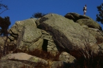
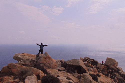
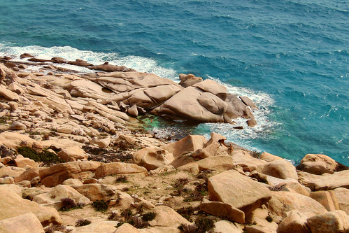
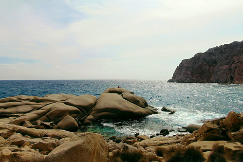
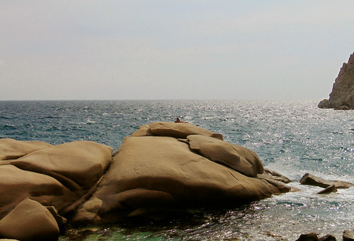
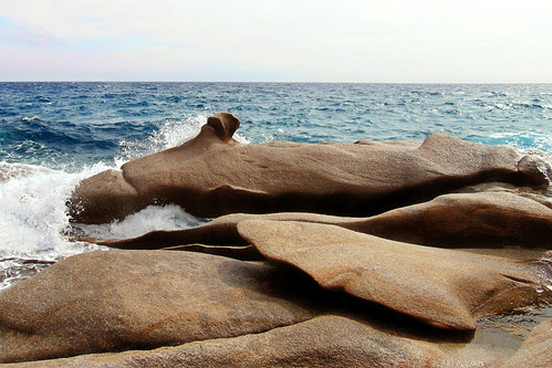
As I started this article, my intention was to present to the world the aestetic and environmental value of the limestone surfaces, crests and cliffs in a very special part of «Atheras», the ridge which makes the backbone of my island, Ikaria. This part is called «Pounta», a hellenized Italian word used by old seamen to describe a sticking out edge or protrusion of rocks like a promontory into the sea.
But after writing a few words, I changed my mind. I had to change my approach on the subject. You see, the landscape of Pounta is not at all «beautiful» in the common understanding of the word. Nor is the environmental value of this endless succession of barren, fragmented and cragged surfaces an easy thing to explain to a broad public. You see (again), along the irregular leaning pyramids of Pounta there is no water and none but very few weather beaten trees, the vegetation being restricted to thorny spurges of all kinds and sizes growing in the gaps between the limestone slabs.
It’s a nothingness, an emptiness, an inhospitable rocky wilderness.
But on the other hand, it’s one of the most impressive (read, majestic) landscapes I’ve seen in my life.
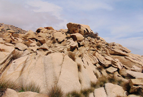
I’ve read that otherworldly landscapes like this were shaped by the movement of ancient glaciers. I can understand that for mt Olympus, but glaciers in Ikaria?! Glaciers in the Aegean Sea?! Well, if you want my opinion, I prefer this explanation than no explanation at all. After all, we had dwarf mammoths and rhinos 50.000 years ago. Why couldn’t we have had glaciers as well?
Anyway, my point here isn’t hard science. My point is the effect these landscapes can have to the soul of the traveller -in this case, the hiker.
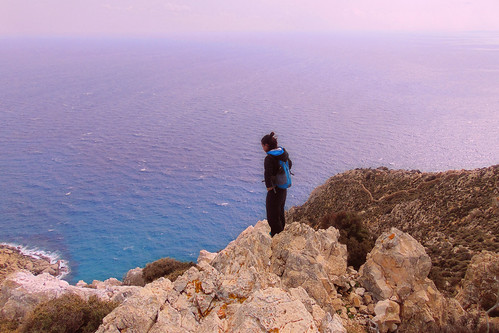
I’ve already written about it when I blogged on a similarly dramatic landscape in another side of the island. It was one of the most destitude and wildest places I know, but – oh my God! – so spectacular! There I experienced strong feelings of anchoritism, like a voice calling me to escape from the worldly turmoil and settle for the rest of my life among dark hanging rocks on one side and the blue immensity on the other.
Now, as I crossed Pounta for the first time (that was in 2006) I experienced a similar, though somehow different feeling. It wasn’t about God; it was about me, as a human being. I felt brave and I felt strong and I felt persistent and decisive. Especially when few years a fter I tried the crossing again and the weather – as it usually happens up there – switched to gale and blew upon us thick blankets of vapor and dence sheets of fog.
In one word, I felt indomitable. 🐲
.


.
I love all the wild untamable landscapes of my island. By challenging my fears and reservations, they have strengthened my character through the years and helped me evolve to a more self-confident and more independent person.
However, in spite of their timeless, unshakeable appearance, limestone crests and cliffs like Pounta are very complicated and extremel y fragile landscapes. Human activities of a gigantic industrial scale, such as the rumored installation of 110 mega-size wind turbines, would totally anihilate their actual high quality. An industrial eolian plant on mt Atheras would devastate Pounta. The prodigious ammount of excavations needed to install these monsters will sooner than later turn its proud crests to mere piles of gravel – piles of gravel rolling and dropping on our heads!
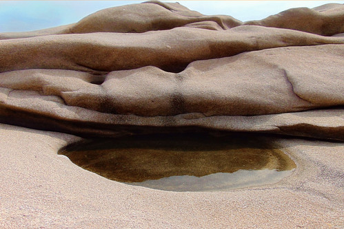
But enough with words. Just below you can see a choice of photos from a recent hiking day trip across the limestone crests of Pounta taken by my friends the OPS Ikarians.
I chose them from 1) Flickr, 2) Google, an d 3) the photos contained in the Google map of the hike. If you like this visual evidence and therefore, you think like me that this very special landscape should stay untouched by capitalist piracy, please consider signing the petition! 📜
 ⭐ ⭐ ⭐
⭐ ⭐ ⭐
.


, on OPS Ikarias Google photos")
 on OPS Ikarias Google photos")


…..
.

Afterword: This was eventually one more article about the landscapes of Ikaria with a stress on the mountainous nature of the island. I wonder when I will post another one. I do hope that I’ll do that soon, though. All I know right now is that the land is closing in for winter and everybody is picking olives …
Eleni Ik ❤
Wednesday, October 23, 2019
Seven Power Spots in Ikaria
Δημοσιεύθηκε: 4 Δεκεμβρίου, 2018 Filed under: choses vécues, exploring, hiking, holidays, ikaria, pleasure, travel, Uncategorized | Tags: adventure, aegean, atheras, eleni-in-ikaria, explorers, Google maps, Greece, hiking, hiking map, hiking trails, ikaria, χάρτης, Ορειβατικός Πεζοπορικός Σύλλογος Ικαρίας, ΟΠΣ Ικαρίας, ικαρία, μονοπάτια, Mountain Climbing and Hiking Association of Ikaria, my-friends, OPS Ikarias, self-guided hiking 12 Σχόλια.
Hello readers!
The Sturmvogel 💗
said «Soul Powered Works»!
And I say now «Seven Power Spots»!!!
It’s wintertime and summer is a long way ahead, so let’s forget «narcinstagram» 🙂 for a while and get down to serious business. Because here I am going to catch the pending threads from Nana’s glorious old article «Hiking routes…» and weave some more cloth on the loom.
 Skip the metaphors…
This article is actually about the work of Hiking Club of Ikaria in mapmaking! Let me quote Nana’s words about these people…
«In spite the lack of support by government and privates, OPS Ikarias are doing more than their best to promote hiking in Ikaria. In the course of time they have literally built with their hands a large network of very popular hiking routes in the island’s varied landscapes and since 2014 when they owned a page in Google they started making Google maps of some of these hikes. Though I have helped several times, it is never enough. There is and there will always be plenty more to do.»
«This entry stands as a due tribute, promotion and encouragement to their effort. As I said and as surprising as this can be, the OPS Ikarias are not funded by anybody. On the other hand, as far as marking and mapping the paths are concerned, given that they are very few and that the terrain of the island is very rough and complicated, they haven’t done badly at all!»
«However, their task is far from being concluded. The maps that I am presenting below to do not correspond to organized, marked and clearly secure trails of the kind we see in other parts of the world. So very often advise and guidance in needed in advance. But the good thing is that the OPS Ikarias are residents who live on the island all year long. So, before you take up any of these hikes, I am asking you to get in contact with them either through their Google page, blog, photo gallery on Flickr and group on facebook.»

And I, how am I involved? Well, I was the naive and ignorant newcomer who put a few red marks on this map of Ikaria and posted it on my blog back in 2006. It became so popular so fast on the net that I felt awkard and had to take it down (Nana, our good archiver, stored it though). You see, although I have done a lot in this direction, I wouldn’t take it on me to draw maps of my island, thus offering reliable guidance across its exciting but rough, exhausting and sometimes dangerous landscapes.
 These times are over! Since that old red marker stained sheet of paper, we have had fine quality digital mapmaking on the net, interactive, with a signature, and for free, created by OPS Ikarias for the sake of hiking, nature, tradition, pleasure and sport. There is so much love into this things that I have decided to call the places included in these maps -places where they have dedicated so much time and work (Soul Powered Work!)– I have decided to call them «Power Spots»!
How many are they until now? 1, 2, 3, 4, 5, 6, 7 !!!
So here they are, dear readers, nature lovers and possible future hikers of Ikaria, the Seven Power Spots of the island, checked, signed, branded and… blogged!
 Love
Love
Eleni
your faithful weaver
. 💗’
.
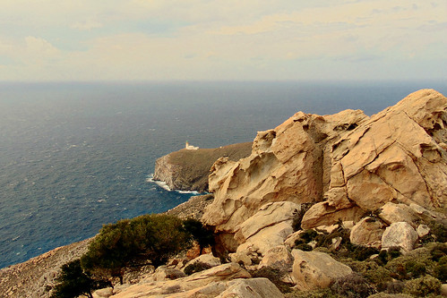
1) The Lighthouse of Kavo Papas
Check the OPS Ikarias review of the location
About the trail, check the OPS Ikarias map:
«Karkinagri – Kavo Papas»
and the amazing photos included in my article:
«A Day at an Exhibition»
2) «Σπιτάκι της Μαμής»
Check the OPS Ikarias review of the location
and my article: «The little house in the desert»
3) Δάσος Ράντη
See also my richly illustrated article:
«Legends about Ikaria: The Forest of Radi»
«The Round of Radi Forest on Foot»
(See also their review of the location)
4) ΛΑΓΚΑΔΑ
[♦] See the location on the map and read
the OPS Ikarias review loaded with many recent photos.
[♦] See the map & description of the 1st hiking route in the area:
«HINTERLAND»
A hiking round in the wild mountains of western Ikaria
Also in the OPSI blog: «HINTERLAND»,
γύρος στην ορεινή ενδοχώρα της δυτικής Ικαρίας.
[♦] See the map & description of the 2nd hiking route in the area:
«On the old dry stone built trails of Northwestern Ikaria»
Mavrianou – Vrakades – Langada – Amalou
5) Crossing Mt Atheras from north to south
With a stop for a meal in Taverna Plaka».
[Read the OPS Ikarias review of this place]
Map of the hike:
«Karavostamo – Dokimi – Arethousa – Chrysostomo»
Photos:
«Karavostamo – Dokimi – Arethousa – Chrysostomo»
The Pictures!!!
6) Chalares Canyon
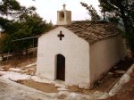
[♦] The beautiful area and the old chapel of «Ai Giannis»,
also the epicenter of the «Musical Yards» events in July.
[♦] Read the OPS Ikarias review
about the trail in the Canyon.
[♦] Finally, for the experienced, the bold and the demanding:
«The Round of Upper Chalares Canyon»
7) Μονοπάτι του Αθέρα
[♦] This amazing long trail running on Ikaria’s high mountain ridge starts from the Tower of Drakano. Read the OPS Ikarias review of the place and check out the location on the map.
[♦] About the trail read the OPS Ikarias review
and check out the starting point.
[♦] Finally, the map of the first part of this hike. It’s one of the best I’ve seen on Google maps! I so hope OPS Ikarias will continue with this project!
«THE TRAIL OF ATHERAS RIDGE»
.
Related articles in my blog:


.
⭐ ⭐ ⭐
Finally, don’t miss to buy the new hiking map of Ikaria by ANAVASI EDITIONS!
All of these locations and trails are included, and even more, most of which offered gratis by the Ikarian Hiking Club!
Ikaria, Greece
Tuesday, December 4, 2018
Updated
Monday 29, August 2022
….
The little house in the desert
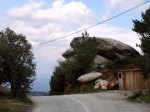
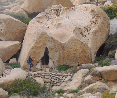
Δημοσιεύθηκε: 10 Ιουνίου, 2017 Filed under: choses vécues, hiking, holidays, ikaria, photography, pleasure, stories, travel, Uncategorized | Tags: adventures, Aegean Sea, atheras, balancing rocks, Google maps, Greece, heritage, hiking, ikaria, ikarians, Κίνηση Πολιτών Ραχών Ικαρίας, Ορεινό Καταφύγιο, εθελοντές, ικαρία, μονοπάτια, mountain shelter, my life, OPS Ikarias, tradition, volunteers 14 Σχόλια.
………The place ![]()
………⭐ ⭐ ⭐
On the wuthering heights of mount Atheraς in the center of a sandy plateau surrounded by windswept round boulders lies a tiny cube-like building with a chimney on its flat roof. This is «To Spitaki tis Mamis» (the little house of the midwife), or «Saint Panteleimon Mountain Refuge», as the marble plate in the wall next to the door says. Built by a kind woman in 1960 for the benefit of all mountain walkers, Spitaki tis Mamis, despite its miniature size, is a mountain shelter properly speaking, not associated to a church or mountain chapel, as it is usual in Greece, but built hiking-wise at important crossroads in a location where a hiker cannot possibly miss. This makes Spitaki tis Mamis, if not the oldest, undoubtedly one of the oldest mountain shelters in the Aegean islands. With my own ears I have heard about the lives it has saved through the years. On the chimney there was a fog bell to guide lost souls in the mountain and inside, as if by a magic hand, it was always provided with firewood, cooking pots, lamps and lamp oil, coffee, sugar, rice etc.
It was a place that wrote history.
However and in spite of all that, in the course of events and new road building in the 1990s Spitaki tis Mamis was forgotten and fell in oblivion. As a result, today -57 years after it was built- it’s in very bad shape: cracked walls, no door and window and a roof almost ready to fall in.
………The project ![]()
………⭐ ⭐ ⭐
Last month, answering  to a request made by several local associations, Spitaki tis Mamis was declared by the Town Council as a cultural monument – standing reminder of the times when there were no roads and cars in Ikaria and the only way to travel from one part of the island to another was by walking long hours across uninhabited, mountainous landscapes in rain, snow or fog. Following this desicion, the Town Council granted permission to the interested parts to repair the old shelter and adapt it to modern needs. As they said, that would be done on the own expences and voluntary work without help from either central or local government…
Volunteers going to work in the wilderness on dream project…?
Oops! I know that! I must help!
………My involvement ![]()
………⭐ ⭐ ⭐
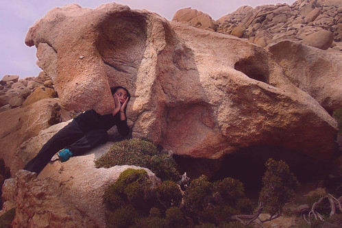
Dear readers, the purpose  of this article is to advertise the aforementioned project and call for funding and support. To do so I can’t find a better way than to show you a set of 16 photos taken many years ago on a hike along half the length of the mountain ridge. That great, mind and soul filling, two-day trip would not have been possible if Spitaki tis Mamis didn’t exist.
In the middle of that desert of rocks, sands, ferns and srubs, although abandonned and broken, it was still there marking the way, connecting the present with the past. It still said «Hello, I am here for you». I want it to be repaired. If not for any other reason, because of an experience I will never forget. Many years ago when I was single and young, while lying in my sleeping bag on its old cracked concrete roof, still warm from the sun,  I gazed at the biggest and brightest summer night sky I’ve seen in my life!
……… The pictures ![]()
………⭐ ⭐ ⭐
.

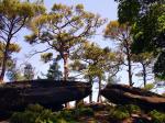
On the path inside Ranti Forest
…..

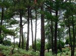
Walking on the ridge and leaving the old forest behind
…..

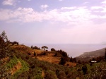
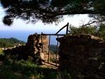
A typical Ikarian rock house on the way to Rahes
…..

Checking the map in the sunset. Got to reach that mountain shelter before nightfall
…..

Unpacking inside the tiny mountain shelter
…..

The fireplace!
…..

Sunrise on Ammoudia plateau, alt. 860 m.
…..


On the road inside Erifi plateau in the morning
…..

In view of forested uplands
…..

Hike across barren wastelands
…..

In view of the southern coast at last
…..

Walking down to Karkinagri on a beautiful stone paved lane for a while
…..

Old houses built on steep ground in the historical part of the village next to a very violent mountain torrent
…..

…..
That was all from me for now. You can read the official account of the project at this link. For donations, as well as for extra hands, you may write to opsikarias2008@gmail.com and/or kinisi.politon.ikaria@gmail.com. I will keep you up to date for further developments.
Follow me up! ![]()
Eleni Ik ❤
…..
Saturday, June 6, 2017
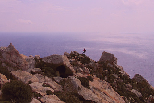
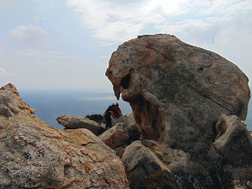
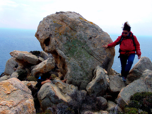
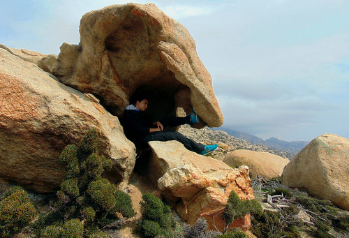
A Day at an Exhibition
Δημοσιεύθηκε: 26 Μαρτίου, 2017 Filed under: choses vécues, exploring, hiking, holidays, ikaria, photography, pleasure, stories, travel, Uncategorized | Tags: adventure, aegean, angelos, art, explorers, flickr, Google maps, Greece, hiking, hiking trails, ikaria, χάρτης, Κάβο Πάπας, Ορειβατικός Πεζοπορικός Σύλλογος Ικαρίας, ΟΠΣ Ικαρίας, ικαρία, μονοπάτια, landscape, landscapes of others, map, March, Mavri, my-work, OPS Ikarias, photography, rocks, wild swimming 14 Σχόλια- .
Dear readers💗As things are at my work I sometimes have to stay for hours at nerve-racking standbys. To relax tension the trick is always to turn my mind to Ikaria and then to look for something interesting to blog about my island. In most cases things don’t fall in as I wish. Inspiration is a bird in flight, but sometimes there are exceptions.😋
 Last week during one of those standbys I mentionned above, and while I was surfing fruitlessly in Flickr, I looked for new stuff from friends and a wonderful new set of 29 pictures from Ikaria appeared in front of my eyes: «A Day at an Exhibition» – «Hard hiking, wild swimming and admiring rocks scuptured by nature in Cape Papas, Ikaria». What a brilliant title, description and of course, visual content!These pictures were taken by my friend Angelos, amateur photographer and leading member of the Ikarian hiking club, on a day of March while he and his friends were trying to find a trail through «a jungle of rocks sculptured by nature» (sic) to connect the remote village of Karkinagri with the even remoter westernmost tip of Ikaria and the historical, spectacular lighthouse which stands on it.... ⭐ ⭐ ⭐ ...As you could see in this great map above, the trail was found! Therefore, I think we should expect to see more shots from this colorful and naturally artistic, wild coast of Ikaria very soon. But for the time being, these are the best I have seen. I am letting you enjoy them! Move your mouse over the thumbnails to read a few words written by the author about each picture. They are very expressive and enlightening!..
All pictures © Mountain Climbing & Hiking Club of Ikaria


. .
 .
.
Côte de Naufragés Sauvés
Thank you very much, Angelos and
the other friends from OPS Ikarias!💗
Sunday, March 26, 2017
Two big hikes Google mapped!
Δημοσιεύθηκε: 28 Φεβρουαρίου, 2015 Filed under: choses vécues, exploring, hiking, ikaria, photography, travel | Tags: adventure, aegean, angels' pools, atheras, ecotourism, empty-landscapes, forest, Google maps, Greece, highlights, hiking, hiking trails, ikaria, Δάσος Ράντη, ικαρία, μονοπάτια, June, map, naked, OPS Ikarias, out of the beaten path, photography, Radi, Ratsos, tourism, Upper Chalares 5 Σχόλια.

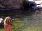
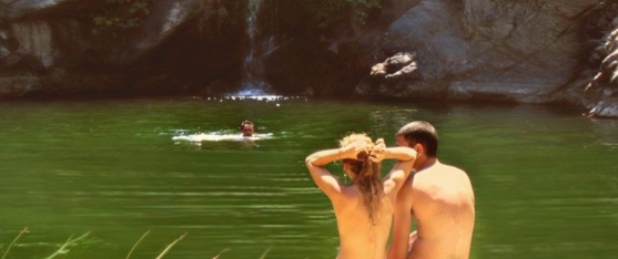
One’s own country is the country where one does not need a map, even less a Google map with coordinates, to go around. But Ikaria is not your country so maybe you do. As a matter of fact, I think you do. Our little island is very complicated and if you have a doubt just go and browse through my «landscapes of others» set of illustrated entries. I’d rather see people walking these landscapes, instead of those disastrous goats, therefore, besides my explorers, I hold in great esteem the people who make maps and share them with the world, evenmore, when these people go for originality, have good taste and stay away from clichés. ![]()
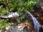
As you have assumed, since my last entry about the «Ikaria Guidebook», I have changed course, and have taken on to the practical side of things. Let’s say, how about hiking safely in the famous but little known, ancient Forest of Radi? How about going in the depths of the upper part of Chalares canyon to find waterfalls and pools to swim naked? 😉
Don’t worry about crowds, ’cause the articles that I will suggest speak about places only for the few. And I would be surprised if you met even few. Take my word, I have been in both these places several times and in spite their breathtaking wild beauty, I never met a living soul!
Although Ikaria has all the assets to become an AAA mountain and outdoor destination, nobody on the island seems to care to know what to do about it so things are left to chance. Taking everything into account, it doesn’t matter. With the exception of the short tourist boom of August, we are and, as it seems, we will always be an island for the few – the few hunters of adventure in a wild and exciting unknown! 😎
But even hunters of adventure need help sometimes…
.
The first Google mapped hiking route I would like to present to you today was created by the local Mountain Climbing &’ Hiking Association (OPS Ikarias) and it is about a circular hike in the Forest of Radi which lies between the village of Petropouli in Messaria and the village of Frantato in Perameria. Their blog can be easily translated through Google translate, so here is what they say in the announcement of the completion of this hiking route:
«Hello Readers! After many hiking trips and searches which ended in defining a circular route in Radi Forest, our Hiking Club proudly presents the digital map: «The Round of Radi Forest»!»
They have indeed made many trips and searches and their Google map the best evidence. This document contains 70 pins with coordinates along an intricate trail of more than 12 kilometers, most of them inside a thick forest, as well as 145 photos! If not for anything but only to appreciate the ammount of their work I think it’s worthwhile to zoom in to make a virtual walk from pin to pin and browse through the pictures. What a feat! But as they said when I asked, that magical forest was worth it!
If you click on the image below you will be transported to the OPS Ikarias website where you can read/translate their entry. At the end there is a list of advice and instructions which you may find useful before you do this hike.

…..
And now, after thick mysterious woods, let’s speak about rocks, sun and river water. Do you remember our friend Zdeněk Šenkyřík, the Czech photographer who I praised in my blog last July? Well, Zdeněk recently revisited his material from Ikaria as well as other islands and reorganized everything into something that I would call «Do it like Zdeněk!»

…..
…..
Introducing his chapter about Ikaria Zdeněk says:
«In 2014 while we were planning our trip to Samos, we made a small change to visit Ikaria as well. We wanted to get to know this paradise for lovers of wild nature – canyons, waterfalls, mountain hikes – awesome!»
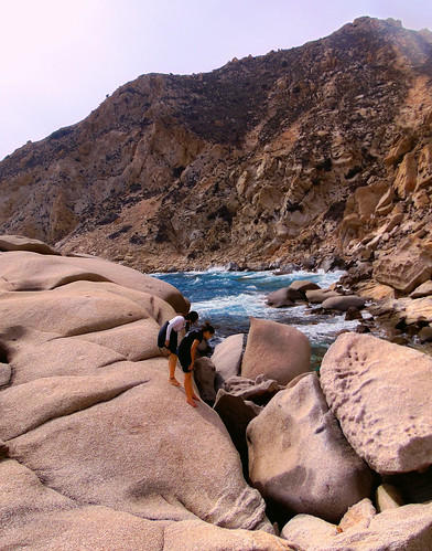
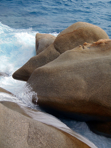
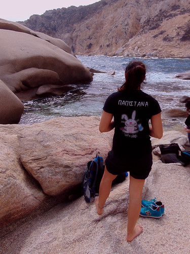
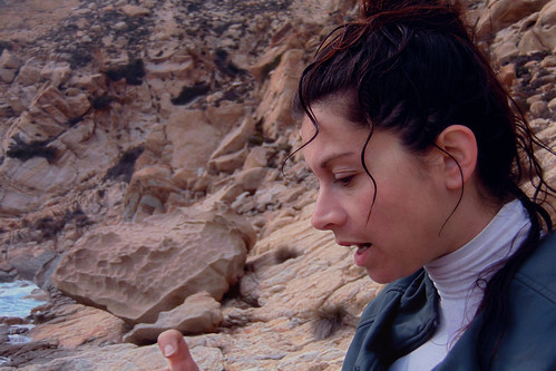
 Indeed, once on the island last June he and his partner Petra were guided by the members of OPS Ikarias and they discovered several places of the kind they were looking for. A list of these spots which are so well shown in Zdeněk’s photos appears in a Google map inside the general page about Ikaria. But the best map and the best photos are included in the subchapter «Chalares Ikaria – swimming in waterfalls». Click on the image below to be transported to that page. We ❤ Zdeněk and Petra!
…..
…..

…..
……….
Still, before closing this, I have to advise everybody who found these hikes appealing to read again my forenote about the situation in Ikaria about hiking. To find and explore safely and succesfully the amazing forest of Radi or the wild and secluded upper part of Chalares canyon the best thing to do is to contact the members of OPS Ikarias, either at their blog which is open to comments or at their facebook page. Like they did with the Czech friends, not only they will be willing to help but they will also have other interesting suggestions according to your likes and the time of the year.
…..
Eleni Ik ❤
Saturday February 28, 2015


")


")


Πρόσφατα σχόλια