
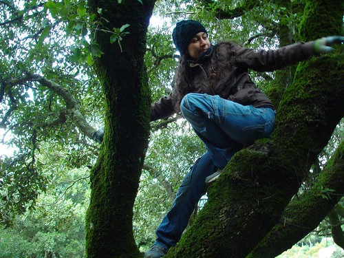
Αχ, αυτός ο Συλλογος! 😚
Δημοσιεύθηκε: 19 Δεκεμβρίου, 2021 Filed under: choses vécues, exploring, hiking, ikaria, stories | Tags: adventure, aegean, atheras, environment, facebook, Greece, hiking, hiking trails, ikaria, Ικαρία, Ορειβατικός Πεζοπορικός Σύλλογος Ικαρίας, ΟΠΣ Ικαρίας, ελληνικά-entries, μονοπάτια 10 Σχόλια«Τα μονοπάτια δεν είναι μόνο για εκείνους που τα περπατούν. Η αφθονία, η ποικιλία και η ποιότητά τους είναι πλούτος γενικά για έναν τόπο.».
Τους αγαπω πολυ και θελω να το δειξω ταιριαζοντας σε αυτο το αρθρο δικες μου παλιες φωτογραφιες απο το μπλογκ μου και απο το φλικρ μαζι με μερικες δικες τους προσφατες δημοσιευσεις απο τη σελιδα τους στο facebook.
OPS Ikarians συνεχιστε ετσι και το 2022.
Σε αυτη τη σκοτεινη και
δυσκολη εποχη μου
δινετε ελπιδα!

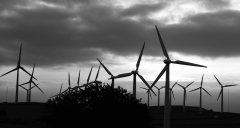
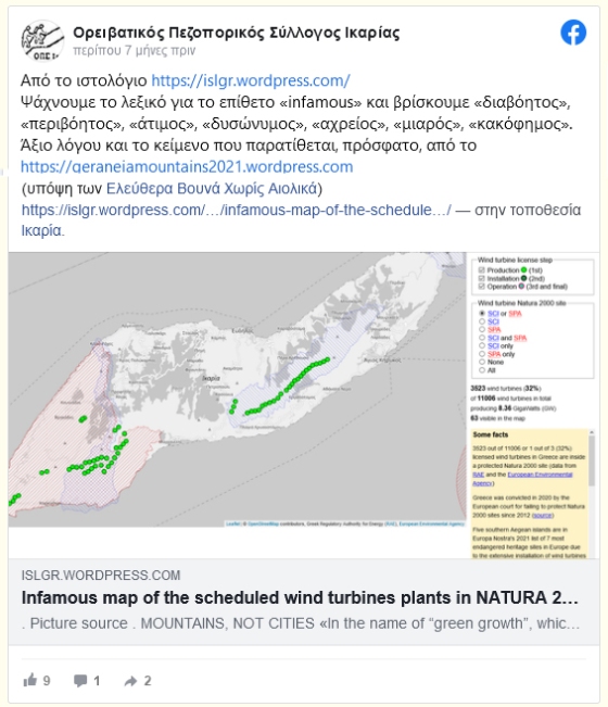
«150 ανεμογεννήτριες σε Ικαρία και Φούρνους. Δεν θα μείνει κορυφή όρθια από τους δρόμους, τα καλώδια, τους υποσταθμούς, τα τσιμέντα και τις ανεμογεννήτριες…»

«Την περασμένη Κυριακή ο Σύλλογός μας πραγματοποίησε την πργραμματισμένη πεζοπορία μας, η οποία ξεκίνησε από το χωριό «Στελί» της Μεσαριάς και κατέληξε στον Κάμπο. Ευχαριστούμε όσους συμμετείχαν…»
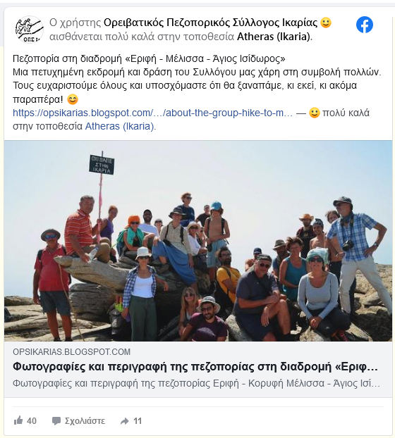
«Πεζοπορία στη διαδρομή «Εριφή – Μέλισσα – Άγιος Ισίδωρος»: Μια πετυχημένη εκδρομή και δράση του Συλλόγου μας χάρη στη συμβολή πολλών. Τους ευχαριστούμε όλους και υποσχόμαστε ότι θα ξαναπάμε, κι εκεί, κι ακόμα παραπέρα! 😊»

«Thank you!😊 Thank you!😊 Thank you!😊»
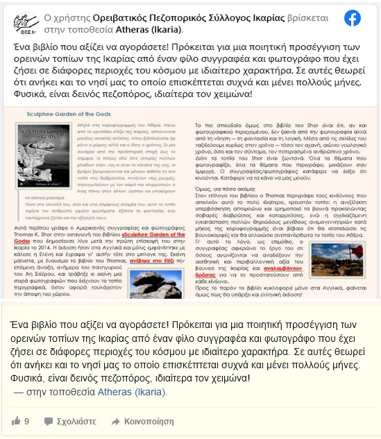
«Ένα βιβλίο που αξίζει να αγοράσετε! Πρόκειται για μια ποιητική προσέγγιση των ορεινών τοπίων της Ικαρίας από έναν φίλο συγγραφέα και φωτογράφο που έχει ζήσει σε διάφορες περιοχές του κόσμου με ιδιαίτερο χαρακτήρα. Σε αυτές θεωρεί ότι ανήκει και το νησί μας το οποίο επισκέπτεται συχνά και μένει πολλούς μήνες. Φυσικά, είναι δεινός πεζοπόρος, ιδιαίτερα τον χειμώνα!»
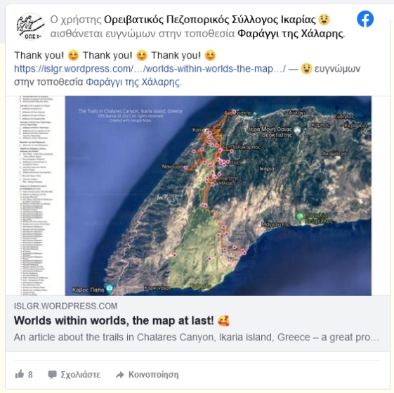
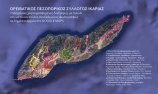
«Τα μονοπάτια δεν είναι μόνο για εκείνους που τα περπατούν. Η αφθονία, η ποικιλία και η ποιότητά τους είναι πλούτος γενικά για έναν τόπο. Το παράδειγμα αφορά τα μονοπάτια που έχει χαράξει ο Σύλλογός μας στο Φαράγγι της Χάλαρης τα οποία μόνο σε αυτήν την περιοχή έχουν συνολικό μήκος 42,35 χλμ!»

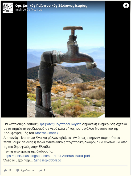
«Για κάποιους δυνατούς Ορειβάτες Πεζοπόροι Ικαρίας σημαντική ενημέρωση σχετικά με τα σημεία ανεφοδιασμού σε νερό κατά μήκος του μεγάλου Μονοπατιού της Κορυφογραμμής του Αθέρα.»
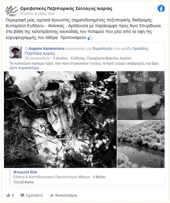
«Περιγραφή μιας σχετικά άγνωστης σηματοδοτημένης πεζοπορικής διαδρομής: Κυπαρίσσι Ευδήλου – Φοίνικας – Αρέθουσα με παράκαμψη προς Άγιο Σπυρίδωνα, στα βάθη της καταπράσινης λαγκαδιάς του ποταμού που ρέει από τα ύψη της κορυφογραμμής του Αθέρα.»
«Ψάχνουμε το λεξικό για το επίθετο «infamous» και βρίσκουμε «διαβόητος», «περιβόητος», «άτιμος», «δυσώνυμος», «αχρείος», «μιαρός», «κακόφημος».»
.


.
.
Ελενη
💗
Κυριακη, 19 Δεκεμβριου, 2021
.
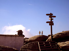
Seven Power Spots in Ikaria
Δημοσιεύθηκε: 4 Δεκεμβρίου, 2018 Filed under: choses vécues, exploring, hiking, holidays, ikaria, pleasure, travel, Uncategorized | Tags: adventure, aegean, atheras, eleni-in-ikaria, explorers, Google maps, Greece, hiking, hiking map, hiking trails, ikaria, χάρτης, Ορειβατικός Πεζοπορικός Σύλλογος Ικαρίας, ΟΠΣ Ικαρίας, ικαρία, μονοπάτια, Mountain Climbing and Hiking Association of Ikaria, my-friends, OPS Ikarias, self-guided hiking 12 Σχόλια.
Hello readers!
The Sturmvogel 💗
said «Soul Powered Works»!
And I say now «Seven Power Spots»!!!
It’s wintertime and summer is a long way ahead, so let’s forget «narcinstagram» 🙂 for a while and get down to serious business. Because here I am going to catch the pending threads from Nana’s glorious old article «Hiking routes…» and weave some more cloth on the loom.
 Skip the metaphors…
This article is actually about the work of Hiking Club of Ikaria in mapmaking! Let me quote Nana’s words about these people…
«In spite the lack of support by government and privates, OPS Ikarias are doing more than their best to promote hiking in Ikaria. In the course of time they have literally built with their hands a large network of very popular hiking routes in the island’s varied landscapes and since 2014 when they owned a page in Google they started making Google maps of some of these hikes. Though I have helped several times, it is never enough. There is and there will always be plenty more to do.»
«This entry stands as a due tribute, promotion and encouragement to their effort. As I said and as surprising as this can be, the OPS Ikarias are not funded by anybody. On the other hand, as far as marking and mapping the paths are concerned, given that they are very few and that the terrain of the island is very rough and complicated, they haven’t done badly at all!»
«However, their task is far from being concluded. The maps that I am presenting below to do not correspond to organized, marked and clearly secure trails of the kind we see in other parts of the world. So very often advise and guidance in needed in advance. But the good thing is that the OPS Ikarias are residents who live on the island all year long. So, before you take up any of these hikes, I am asking you to get in contact with them either through their Google page, blog, photo gallery on Flickr and group on facebook.»

And I, how am I involved? Well, I was the naive and ignorant newcomer who put a few red marks on this map of Ikaria and posted it on my blog back in 2006. It became so popular so fast on the net that I felt awkard and had to take it down (Nana, our good archiver, stored it though). You see, although I have done a lot in this direction, I wouldn’t take it on me to draw maps of my island, thus offering reliable guidance across its exciting but rough, exhausting and sometimes dangerous landscapes.
 These times are over! Since that old red marker stained sheet of paper, we have had fine quality digital mapmaking on the net, interactive, with a signature, and for free, created by OPS Ikarias for the sake of hiking, nature, tradition, pleasure and sport. There is so much love into this things that I have decided to call the places included in these maps -places where they have dedicated so much time and work (Soul Powered Work!)– I have decided to call them «Power Spots»!
How many are they until now? 1, 2, 3, 4, 5, 6, 7 !!!
So here they are, dear readers, nature lovers and possible future hikers of Ikaria, the Seven Power Spots of the island, checked, signed, branded and… blogged!
 Love
Love
Eleni
your faithful weaver
. 💗’
.
1) The Lighthouse of Kavo Papas
Check the OPS Ikarias review of the location
About the trail, check the OPS Ikarias map:
«Karkinagri – Kavo Papas»
and the amazing photos included in my article:
«A Day at an Exhibition»
2) «Σπιτάκι της Μαμής»
Check the OPS Ikarias review of the location
and my article: «The little house in the desert»
3) Δάσος Ράντη
See also my richly illustrated article:
«Legends about Ikaria: The Forest of Radi»
«The Round of Radi Forest on Foot»
(See also their review of the location)
4) ΛΑΓΚΑΔΑ
[♦] See the location on the map and read
the OPS Ikarias review loaded with many recent photos.
[♦] See the map & description of the 1st hiking route in the area:
«HINTERLAND»
A hiking round in the wild mountains of western Ikaria
Also in the OPSI blog: «HINTERLAND»,
γύρος στην ορεινή ενδοχώρα της δυτικής Ικαρίας.
[♦] See the map & description of the 2nd hiking route in the area:
«On the old dry stone built trails of Northwestern Ikaria»
Mavrianou – Vrakades – Langada – Amalou
5) Crossing Mt Atheras from north to south
With a stop for a meal in Taverna Plaka».
[Read the OPS Ikarias review of this place]
Map of the hike:
«Karavostamo – Dokimi – Arethousa – Chrysostomo»
Photos:
«Karavostamo – Dokimi – Arethousa – Chrysostomo»
The Pictures!!!
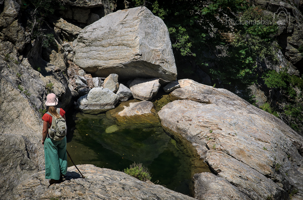
6) Chalares Canyon
[♦] The beautiful area and the old chapel of «Ai Giannis»,
also the epicenter of the «Musical Yards» events in July.
[♦] Read the OPS Ikarias review
about the trail in the Canyon.
[♦] Finally, for the experienced, the bold and the demanding:
«The Round of Upper Chalares Canyon»
7) Μονοπάτι του Αθέρα
[♦] This amazing long trail running on Ikaria’s high mountain ridge starts from the Tower of Drakano. Read the OPS Ikarias review of the place and check out the location on the map.
[♦] About the trail read the OPS Ikarias review
and check out the starting point.
[♦] Finally, the map of the first part of this hike. It’s one of the best I’ve seen on Google maps! I so hope OPS Ikarias will continue with this project!
«THE TRAIL OF ATHERAS RIDGE»
.
Related articles in my blog:


.
⭐ ⭐ ⭐
Finally, don’t miss to buy the new hiking map of Ikaria by ANAVASI EDITIONS!
All of these locations and trails are included, and even more, most of which offered gratis by the Ikarian Hiking Club!
Ikaria, Greece
Tuesday, December 4, 2018
Updated
Monday 29, August 2022
….
OASIFICATION! 🌳 🌳 🌳
Δημοσιεύθηκε: 30 Σεπτεμβρίου, 2017 Filed under: choses vécues, exploring, hiking, ikaria, photography, stories, Uncategorized | Tags: aegean, atheras, deforestation, desertification, environment, goats, Greece, ikaria, ikarians, Αθέρας, Κίνηση Πολιτών Ραχών Ικαρίας, ΟΠΣ Ικαρίας, Σπιτάκι της Μαμής, ικαρία, lets-plant-oaks, my-friends, oasification, OPS Ikarias, photography, portraits, preservation, volunteers 7 Σχόλια
WTF is this word? 😵 ❓ ❓
According to YourDictionary: Oasification
«The process of restoring water, soil, and plant life to an environment that has been degraded by soil erosion.»
According to the Wikipedia: Oasification
«In hydrology, oasification is the antonym to desertification by soil erosion. This technique has limited application and is normally considered for much smaller areas than those threatened by desertification.»
«To help the oasification process, engineers aim to develop a thriving dense woody plant cover to redress the hydrological, edaphic and botanical degradation affecting a slope.»
According to writer F. R. Chateaubriand: Oasification
«Forest precedes Man and desert follows him. Thus has ocurred with many civilizations that we know, settled in arid and semiarid territories. However, desertification is not an irreversible and hopeless process. In this new millenium we must be able to find the solutions to the problems that we generate. Against desertification: Oasification!»

According to the declaration of the three Ikarian Associations mentionned
at the end of my previous article «The little house in the desert»
«Besides that, again with our voluntary work, we intend to fence an area of at least 8.000 square meters around the shelter in order to protect it from the goats. This way, we will allow at least a small part of the overgrazed, eroded and almost desertified mountain plateau to grow green again like it was in the past.»
«Among the benefits resulting from this [project will be] the awakening of the local community concerning the desertification of the mountain volume of Ikaria through creating a visitable framed green space where endemic species will grow. This way, it will be proven in practice that this phenomenon and its disastrous effects (flashfloods, landslides, impoverishment of the soil) is not a natural, inevitable process but something that started for specific reasons [only] few decades ago and therefore, there is a way to stop it.»
«But most of all, what we want to do is to show with a project of our own -no matter its smallness- the great love we feel for our mountain, its freedom and its wild beauty.»
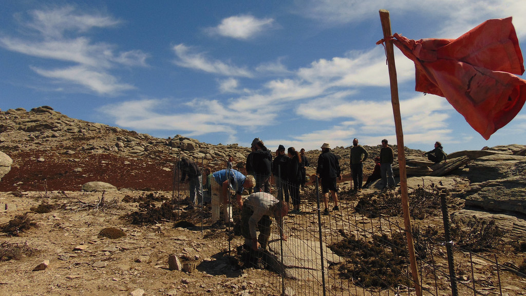
Well, t hey’ve done it!!!! Against all odds (bureaucracy, indifference, fatalism, pessimism and hostile goat barons) on Sunday, September 24, more than 40 young local people gathered on the mountain and after several hours of hard work, they secured an area of 8.000 square meters around the old mountain shelter on Ammoudia plateau with a long line of welded wire mesh panels.
They ‘ve done it! Look at them at work! You can tell from the pictures which are all first quality, the feelings of joy and fulfillment shared by the participants. I am so glad I’ve helped in my own small way to this project. If things go well -and I have every reason to thnk they will- in less than 3 years, instead of that depressive, although sometimes also impressive, goat desert, we will have an oasis!


Notice: The gallery above is made up of 56 pictures I discovered in three posts at the OPS Ikarias Google+ page. They redirected me to three of their facebook posts: the first one, containing 12 pictures taken by my friend Angelos, the second and the third one containing a total of 44 pictures, taken by our friends from Italy, Paola and Ivo, founders of the association «Η ‘δική μας’ Ικαρία».
All pictures © OPSIkarias & DikimasIkaria 2017
For the title of this article I am gratedul to ![]()
who looked up the meaning of the term «oasification» for me and
suggested that it would be more appropriate to describe the project
of fencing instead of the akward «fencing against desertification»
which wouldn’t make much sense to a reader who is not familiar
with our strange island and its strange problems.
.
• opsikarias2008@gmail.com
• kinisi.politon.ikaria@gmail.com
The little house in the desert
Δημοσιεύθηκε: 10 Ιουνίου, 2017 Filed under: choses vécues, hiking, holidays, ikaria, photography, pleasure, stories, travel, Uncategorized | Tags: adventures, Aegean Sea, atheras, balancing rocks, Google maps, Greece, heritage, hiking, ikaria, ikarians, Κίνηση Πολιτών Ραχών Ικαρίας, Ορεινό Καταφύγιο, εθελοντές, ικαρία, μονοπάτια, mountain shelter, my life, OPS Ikarias, tradition, volunteers 14 Σχόλια.
………The place ![]()
………⭐ ⭐ ⭐
On the wuthering heights of mount Atheraς in the center of a sandy plateau surrounded by windswept round boulders lies a tiny cube-like building with a chimney on its flat roof. This is «To Spitaki tis Mamis» (the little house of the midwife), or «Saint Panteleimon Mountain Refuge», as the marble plate in the wall next to the door says. Built by a kind woman in 1960 for the benefit of all mountain walkers, Spitaki tis Mamis, despite its miniature size, is a mountain shelter properly speaking, not associated to a church or mountain chapel, as it is usual in Greece, but built hiking-wise at important crossroads in a location where a hiker cannot possibly miss. This makes Spitaki tis Mamis, if not the oldest, undoubtedly one of the oldest mountain shelters in the Aegean islands. With my own ears I have heard about the lives it has saved through the years. On the chimney there was a fog bell to guide lost souls in the mountain and inside, as if by a magic hand, it was always provided with firewood, cooking pots, lamps and lamp oil, coffee, sugar, rice etc.
It was a place that wrote history.
However and in spite of all that, in the course of events and new road building in the 1990s Spitaki tis Mamis was forgotten and fell in oblivion. As a result, today -57 years after it was built- it’s in very bad shape: cracked walls, no door and window and a roof almost ready to fall in.
………The project ![]()
………⭐ ⭐ ⭐
Last month, answering  to a request made by several local associations, Spitaki tis Mamis was declared by the Town Council as a cultural monument – standing reminder of the times when there were no roads and cars in Ikaria and the only way to travel from one part of the island to another was by walking long hours across uninhabited, mountainous landscapes in rain, snow or fog. Following this desicion, the Town Council granted permission to the interested parts to repair the old shelter and adapt it to modern needs. As they said, that would be done on the own expences and voluntary work without help from either central or local government…
Volunteers going to work in the wilderness on dream project…?
Oops! I know that! I must help!
………My involvement ![]()
………⭐ ⭐ ⭐
Dear readers, the purpose  of this article is to advertise the aforementioned project and call for funding and support. To do so I can’t find a better way than to show you a set of 16 photos taken many years ago on a hike along half the length of the mountain ridge. That great, mind and soul filling, two-day trip would not have been possible if Spitaki tis Mamis didn’t exist.
In the middle of that desert of rocks, sands, ferns and srubs, although abandonned and broken, it was still there marking the way, connecting the present with the past. It still said «Hello, I am here for you». I want it to be repaired. If not for any other reason, because of an experience I will never forget. Many years ago when I was single and young, while lying in my sleeping bag on its old cracked concrete roof, still warm from the sun,  I gazed at the biggest and brightest summer night sky I’ve seen in my life!
……… The pictures ![]()
………⭐ ⭐ ⭐
.

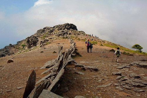
On the path inside Ranti Forest
…..

Walking on the ridge and leaving the old forest behind
…..

A typical Ikarian rock house on the way to Rahes
…..

Checking the map in the sunset. Got to reach that mountain shelter before nightfall
…..

Unpacking inside the tiny mountain shelter
…..

The fireplace!
…..

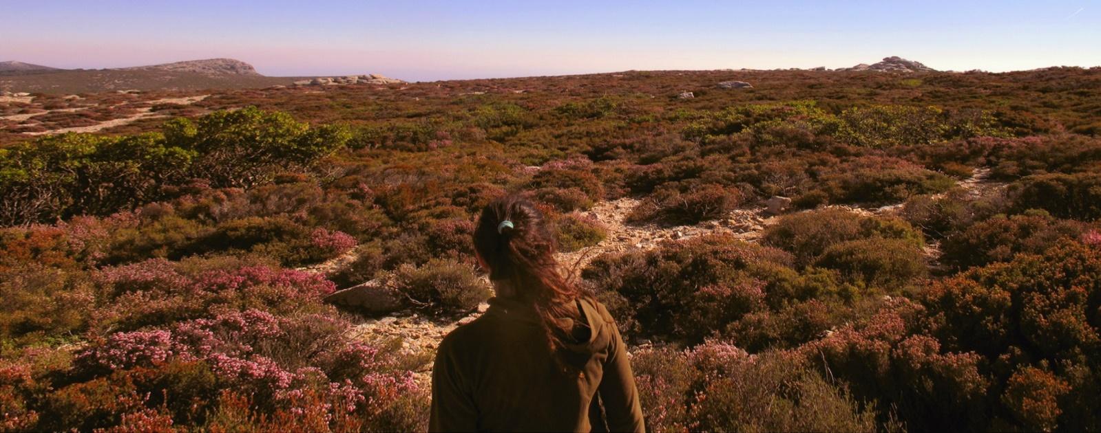
Sunrise on Ammoudia plateau, alt. 860 m.
…..


On the road inside Erifi plateau in the morning
…..

In view of forested uplands
…..

Hike across barren wastelands
…..

In view of the southern coast at last
…..

Walking down to Karkinagri on a beautiful stone paved lane for a while
…..

Old houses built on steep ground in the historical part of the village next to a very violent mountain torrent
…..

…..
That was all from me for now. You can read the official account of the project at this link. For donations, as well as for extra hands, you may write to opsikarias2008@gmail.com and/or kinisi.politon.ikaria@gmail.com. I will keep you up to date for further developments.
Follow me up! ![]()
Eleni Ik ❤
…..
Saturday, June 6, 2017
Windbag of Aeolus
Δημοσιεύθηκε: 17 Οκτωβρίου, 2016 Filed under: choses vécues, exploring, flying, ikaria, stories, Uncategorized | Tags: aegean, atheras, disaster, documentary, empty-landscapes, environment, Greece, greeks-in-crisis, ikaria, island in the aegean sea, Αυτόνομη Συσπείρωση Πολιτών Ικαρίας, ανεμογεννήτριες, ηλεκτρισμός, ικαρία, landscape, Ledeen Doctrine, preservation, wasteland, wild capitalism, wind power, wind turbines 1 σχόλιο.
«Windbag of Aeolus»
«Ο Ασκός του Αιόλου»
.
.
About the documentary, in short
 You cannot conceive the beauty or the ugliness of this world when you are observing it from a distance. You have to approach, dive into its depths and explore… It is only then that awareness and objectiveness are acquired.
Green growth was introduced to Greece round the early ‘80s, when E.U. directives applied to Greek Government energy policy led to the installation of the first wind farm. Since then the number of wind farms has been increasing at an immense rate. The incentive for this investigation was the observation of wind turbines being inconsiderately dispersed across invaluable regions of the mainland and the islands of Greece, in the name of clean, “green energy”.
The main objective of this documentary is to shed light on the environmental, financial and social consequences of this policy and the aftermath of the so-called “high priority” investments supported by huge subsidies.
Why?
 While following this objective numerous questions were raised. Is this energy policy the essence of green growth and if so, could this be considered a truly sustainable form development?
When examining the environmental aspects, one could wonder about the following:
- Which are the spatial criteria for selection of areas of installation?
- Under what kind of environmental assessment sites like forests, conservation areas, sites near traditional settlements or historic sites are approved as suitable?
- Why are those environmental assessments carried out mostly by private companies and not by scientists, and how are their results validated?
- Which are, if there are any, the obligations of the wind farm owners considering the removal of the turbines and the restoration of the environment and who sees that it is actually carried out?
- In other words, is this really a strategy or a predatory way of harnessing renewable energy sources? Could green energy under these circumstances ever be actually “green”?
 Such an obvious lack of strategic planning raises more questions considering the financial aspects of the matter.
- Whom do these “strategic investments” really serve?
- Under what legislation is the constitutionally defined meaning of sustainability being annulled, when permits are being issued inconsiderately and subsidies are given out to one-person companies and affiliates of the same key companies in the energy field?
- Why isn’t there any consideration whatsoever of the actual energy needs of the country?
- Why aren’t those companies fined when they are not meeting their dept to land owners?
- Or, why is the ownership status scouted?
Risks & Challenges
 Τhe strength, support and motivation for this 16-month journey of searching, filming and visiting the farthest corners of Greece came from the people of this land, people who have been conveniently silenced. This raises the biggest question of all:
- Why are all the above taking place while communities around Greece are provided with no official information at all?
- Why are the views of Municipalities totally disregarded in decision making? Why are their arguments, protests, petitions passed by?
- Is this really where the birthplace of Democracy ended up to?
As a production team we decided 16 months ago to open the windbag of green growth in Greece and separate the lies from the truth. We did so being fully aware of the risks involved and while knowing well enough the power of the key players in the energy field in Greece…
—⊥—⊥—⊥—⊥—⊥—⊥—⊥—⊥—⊥—⊥—⊥—⊥—⊥—⊥—
Ο «Ασκός του Αιόλου» με λίγα λόγια
Δεν μπορείς να συλλάβεις την ομορφιά ή την ασχήμια αυτού του κόσμου όταν τον παρατηρείς από μακριά. Πρέπει να τον πλησιάσεις, να βουτήξεις μέσα και να τον εξερευνήσεις… Μόνο τότε αποκτάς πλήρη συναίσθηση και αντικειμενικότητα. Ο όρος και η πρακτική εφαρμογή της πράσινης ανάπτυξης εμφανίστηκαν στην Ελλάδα τη δεκαετία του ’80, όταν η ενεργειακή πολιτική των Ελληνικών κυβερνήσεων, καθοδηγούμενη από τις Ευρωπαϊκές οδηγίες, συναίνεσε στη δημιουργία του πρώτου αιολικό πάρκου. Από τότε ο αριθμός τους αυξάνεται με φρενήρη ρυθμό. Η παρουσία πολυάριθμων ανεμογεννητριών που αλόγιστα φυτεύονται στο όνομα της «πράσινης ενέργειας» σε ανεκτίμητες περιοχές της ηπειρωτικής και νησιωτικής Ελλάδας, αποτέλεσε το έναυσμα της έρευνάς μας. Ο κύριος στόχος του ντοκιμαντέρ είναι να φέρει στην επιφάνεια τις πραγματικές περιβαλλοντικές, οικονομικές και κοινωνικές συνέπειες της εφαρμογής αυτής της πολιτικής και τις «παρενέργειες» τον αποκαλούμενων «στρατηγικών επενδύσεων» που επιδοτούνται αδρά.
Γιατί;
Ακολουθώντας το στόχο αυτό γεννήθηκαν πολυάριθμα ερωτήματα. Αυτή είναι τελικά η ουσία της πράσινης ανάπτυξης και αν ναι, υπό ποία έννοια χαρακτηρίζονται βιώσιμες οι εφαρμογές τέτοιων πρακτικών; Σε ότι αφορά το περιβάλλον ορισμένα μόνο από τα βασικά ερωτήματα που προκύπτουν είναι τα εξής:
- Ποια είναι επιτέλους τα χωροταξικά κριτήρια επιλογής των περιοχών εγκατάστασης;
- Τι είδους και πόσης αξιοπιστίας περιβαλλοντικές μελέτες «επιστημονικά» συναινούν στην επιλογή δασών, προστατευόμενων περιοχών NATURA, σημείων σε απόσταση αναπνοής από παραδοσιακούς οικισμούς και κατοικημένες περιοχές ή ιστορικούς χώρους, ως περιοχών κατάλληλων για εγκατάσταση;
- Γιατί αυτές οι περιβαλλοντικές μελέτες, που συνοδεύουν τις αιτήσεις αδειοδότησης, πραγματοποιούνται κυρίως από ιδιωτικές εταιρείες και όχι από το άρτια καταρτισμένο επιστημονικό προσωπικό των Πανεπιστημίων της χώρας και με ποιον τρόπο ή από ποιο φορέα ελέγχεται η αξιοπιστία των αποτελεσμάτων τους;
- Ποιες είναι οι υποχρεώσεις των ιδιοκτητών αιολικών πάρκων σε σχέση με την απομάκρυνση των ανεμογεννητριών μετά το τέλος της λειτουργικής περιόδου τους και την αποκατάσταση του περιβάλλοντος;
- Ποιος ελέγχει ότι εργασίες αποκατάστασης όντως πραγματοποιούνται;
- Με άλλα λόγια, είναι αυτό στρατηγική και σχέδιο ανάπτυξης, ή απλά ένας ληστρικός τρόπος εκμετάλλευση κοινωνικών αγαθών όπως ο αέρας, το νερό και ο ήλιος;
- Πως θα μπορούσε ποτέ η “πράσινη ενέργεια” να είναι υπό αυτές τις συνθήκες πραγματικά «πράσινη»;
Η προφανέστατη έλλειψη στρατηγικού σχεδιασμού λοιπόν, δεν μπορούσε παρά να γεννήσει ακόμα περισσότερα ερωτήματα, ειδικά σε σχέση με το οικονομικό καθεστώς που επικρατεί στις «επενδύσεις» αυτές.
- Ποιόν εξυπηρετούν στην πραγματικότητα αυτές οι «στρατηγικές επενδύσεις»;
- Υπό ποια νομοθεσία καταργείται στην ουσία η συνταγματικά κατοχυρωμένη έννοια της βιωσιμότητας με την αδιάκριτη έγκριση αδειών και την συνεχή παροχή επιδοτήσεων σε εταιρείες του ενός ατόμου, ή σε θυγατρικές των ίδιων βασικών παικτών στον τομέα της ενέργειας, εγχώριων και ξένων;
- Γιατί παραβλέπονται και αποτελούν δευτερεύον κριτήριο οι πραγματικές ενεργειακές ανάγκες της χώρας;
- Υπάρχει κάποιος μηχανισμός προστασίας των ιδιοκτητών γης όταν δεν λαμβάνουν τα συμφωνηθέντα από τις εταιρείες για την ενοικίαση της γης τους;
- ‘Η, για ποιόν ακριβώς λόγο το ιδιοκτησιακό καθεστώς περιοχών απαξιώνεται και αλλάζει εν μια νυκτί;
Προκλήσεις
Η δύναμη για αυτό το 16μηνο ταξίδι μας προήλθε από τους ανθρώπους της χώρας αυτής που αποτέλεσαν και το ισχυρότερο κίνητρο, γιατί έχουν πολύ βολικά και επιμελέστατα αποσιωπηθεί. Και αυτή ακριβώς η παράμετρος γεννά το μεγαλύτερο ερώτημα από όλα:
- Γιατί όλα τα παραπάνω συμβαίνουν ενώ οι Δήμοι και οι τοπικές κοινωνίες δεν λαμβάνουν απολύτως κανενός είδους επίσημη πληροφόρηση;
- Γιατί οι απόψεις των Δημοτικών Συμβουλίων απαξιώνονται και παραβλέπονται κατά την λήψη των αποφάσεων;
- Γιατί οι διαμαρτυρίες, οι φωνές των ανθρώπων αυτών αποσιωπούνται;
- Εδώ κατέληξε τελικά η γενέτειρα της Δημοκρατίας;
Ως ομάδα παραγωγής αποφασίσαμε πριν 16 μήνες να ανοίξουμε τον Ασκό της πράσινης ανάπτυξης στην Ελλάδα και να ξεχωρίσουμε τα ψέματα από την αλήθεια. Το κάναμε έχοντας πλήρη συναίσθηση των κινδύνων που ελλοχεύουν και γνωρίζοντας πολύ καλά τη δύναμη των μεγάλων παικτών στον τομέα της ενέργειας στη χώρα…
source
.
____________________________________________________
.
.Thursday December 1, 2016 - 10:37pm (EEST)
‘The Hiking Trails of Ikaria’ – illustrated interview by OPS Ikarias
Δημοσιεύθηκε: 14 Μαΐου, 2016 Filed under: choses vécues, exploring, hiking, ikaria, photography, pleasure, stories, travel | Tags: adventure, aegean, atheras, documentary, ecotourism, enviro-lore, good-conspiracy, Greece, hikers, hiking, hiking trails, ikaria, ikaria-in-winter, ikarians, interview, ΟΠΣ Ικαρίας, ικαρία, μονοπάτια, my-friends, OPS Ikarias, people in landscape, photo rapsody, photography, photostory, preservation 11 Σχόλια.
 Hello readers!
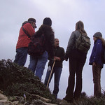
You know that my blog likes interviews and this one… well, it’s a good one because it’s like a documentary! I mean that you can just stare at the photos (loads of them) streaming over the questions and answers, only that I thought that the context was interesting too, so I got into the trouble to translate the whole thing in English and then I sent it over to be added as subtitles to the video on youtube. Which video is an illustrated version of an interview to my good Ikarian friend, Angelos K., founding member and representative of the Mountain Climbing and Hiking Association of Ikaria (OPS Ikarias), by Babis Kokosis for «The Hiking Trails of Greece» a regular radio show on «The Voice of Greece», the international Greek state Radio (ERA 5). Unlike what you might have expected, the pictures do not show landscapes and trails and maps and stuff like that but people!
As the introduction goes:
«The photos showing in this video made by OPS Ikarias were taken along our various hiking trips and many other activities in the nature of Ikaria from 2008 to 2016. They are a tribute to our older and newer friends and members of the Club who walk and enjoy the island’s fascinating landscapes and take part in the club’s projects and activities. They are our inspiration and our one and only support. This video is dedicated to them!»
.
.
***Find button to turn on "subtitles". Seen best in full screen mode!
.
.
You can read my translation of Angelos’s radio interview by opening this link to OPS Ikarias Google docs. The interviewer introduces the show like this:
«Today we will visit Ikaria, an island that has managed, in spite of the growing tourist development, to maintain a big part of its cultural traditions.
The natural particularities of Ikaria are many. They are shaped by the geographical features and the position of the island in the Aegean Sea. Ikaria consists of a long mountainous mass stretching from east to west forming a ridge with heights over 1000 m. and separating the island in two sides: the northern side with mild slopes, forestlands and abundant waters, and the southern side with stony grounds and steep slopes. Therefore, it displays an impressive variety of landscapes and natural sights which the visitor can discover by following its numerous trails while getting in touch with its history and the legendary particular way of life of its inhabitants.
Let’s find out a bit more about the hiking routes of the island as well as what a hiker may encounter in them through our talk with Mr. Angelos Kalokairinos, representative of the local Hiking Club.»read more...
And if you are a Greek reader you can check out the original transcript in this link.
The video, seen best in full screen mode, it goes without saying, includes a selection of pictures from the Flickr Album: «Mountain Climbing and Hiking Club of Ikaria». I have exercised my influence 🙂 and gotten a specially coded link so you can see all the pictures -not only the public ones. So take advantage of this privilege and enjoy an amazing slideshow! But if you just like a quick view, here is the album straight out of Flickr:
⭐ ⭐ ⭐ ⭐
.
.
⭐ ⭐ ⭐ ⭐
.
![]() I WANT MORE OPS Ikarias Videos!!!
I WANT MORE OPS Ikarias Videos!!!
.
[related links]


Eleni Ik

.
Ikaria, May 14 2016
[BIG DAY!]
.
Thick with the eerie awe of the uncanny
Δημοσιεύθηκε: 23 Δεκεμβρίου, 2015 Filed under: choses vécues, exploring, flying, hiking, ikaria, photography, stories, travel, Uncategorized | Tags: adventure, aegean, atheras, balancing rocks, enviro-lore, explorers, ghosts, good-book, Greece, ikaria, island in the aegean sea, χειμώνας, Ορειβατικός Πεζοπορικός Σύλλογος Ικαρίας, ΟΠΣ Ικαρίας, ικαρία, μονοπάτια, OPS Ikarias, Pezi, photography, rocks, Save Atheras, Save Pramnos, stories, up-with-lonely-winter, wild shots 15 Σχόλια- .
. .
. Hello readers! .

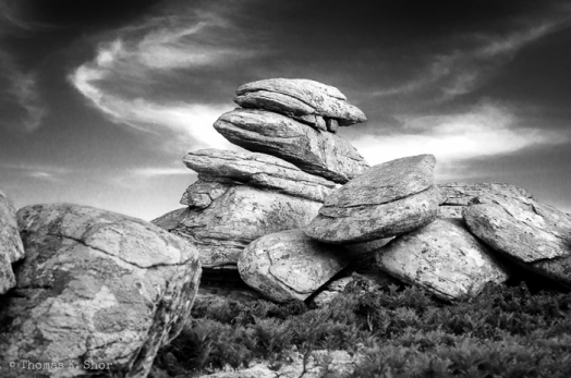
My name is Angelos K. and since I was nominated contributor I am afraid I have written very few articles in this blog. Let’s say that I was saving my blogging skills for special occasions. And as I hope you can tell from the introductory picture, this is a special occasion. The place is Pezi plateau located on the western part of Ikaria island, Greece. The time is two years ago, between December and January 2013. The photographer is Thomas K. Shor, an American writer, photographer and traveller. He and his wife Barbara appeared out of the blue in Ikaria in the middle of a cloudy and rainy winter. During their stay we hiked (a little), we talked (a lot) and we became good friends. Apparently, they liked the island, because they visited us two times. Between their visits I had the chance to read two of Thomas’s books, «A Step Away from Paradise» and «The Master Director» and although I know very little about the places where the action takes place, I liked both of them very much.
 While in Ikaria Thomas often carried a camera but I didn’t pay much attention to the fact. All Americans carry cameras. Until one day when he came to my house and showed to me a pack of high quality B/W prints. Knowing that I am a hiker and an amateur photographer, and therefore, I was familiar with the locations and the subjects, he asked for my opinion about his work. I was all admiration! As a matter of fact, I couldn’t keep my fingers off those prints! Through the years I have seen a lot of great pictures from the desolate landscapes of our mountains but these ones were special. Moreover, they were 100% «Ikaria» and not, as it so often happens, overprocessed creations which, no matter how beautiful they are, I label them «fiction» and I don’t usually give them a second glance. 😕 😕
 I immediately told Eleni about Thomas work and as much of her blog is dedicated to photography, she told me to ask for Thomas’s permission and left the door open for me to get in and post an article about his book. So I did.
Inside Thomas’s article about his book, there is an awesome slideshow where you can view some of his many amazing photos. I borrowed the title of my article: «Thick with the eerie awe of the uncanny», from Thomas’s first draft of the publication. I loved that title! Because, like Eleni, everybody in Ikaria loves ghost stories. How couldn’t we? Just take a look at these photos! Look at the landscapes we live in! Thomas has managed to show that these shapes, these shades, these forms, are alive. More than that, they can talk and tell stories!
⭐ ⭐ ⭐
Below you can see some photos of Thomas K. Shor taken while hiking with our local hiking club, in Ikaria. Further down I have added a few quotes from his book about the island.
….:star: ⭐ :star:….
.


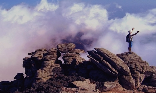
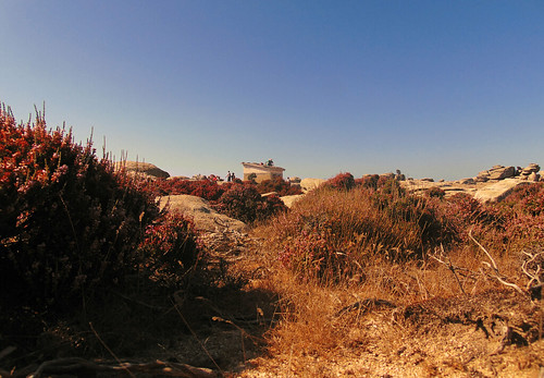
«THE ISLAND OF IKARIA is distinctive for various reasons. It remains to this day an untouristed backwater where people are largely self-sufficient and unusually independently minded. It has been labeled one of the “Blue Zones,” with the highest percentage of people in their nineties on the planet.»
«Historically, it was the poorest island in the Aegean. It is also one of the lushest, with numerous springs and rivers and forests of pine and oak.»
«Yet the landscape photographs I have been taking over the course of a couple of extended stays reflect nothing of this lushness and hardly depict any people.»
«The island is long and thin, a single mountain ridge rising sharply out of the Aegean Sea not far from the coast of Turkey. At the top of this ridge, topped by numerous 3,000 foot (1,000 meter) peaks, is a landscape that haunted and excited me from the moment I set eyes on it.»
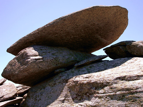
«It is a desolate and windswept land of exposed granite carved by the elements into bizarre shapes and balancing boulders. The granite has a mysterious propensity to take the form of living beings.»
«The trees are stunted and the bushes thorny. It can change from bright sun to near impenetrable fog at such a speed as to be entirely disorienting.»
«The atmosphere is often reminiscent of the stories of Edgar Allen Poe, thick with the eerie awe of the uncanny. The beauty of the place is raw and the solitude profound. This series of photographs, taken on the mountain’s many moods, reflects both the landscape and what it did to me.»

...
Wednesday, December 24, 2015
Updated: Friday, October 26, 2018
τοπια των αλλων plus +
Δημοσιεύθηκε: 25 Σεπτεμβρίου, 2015 Filed under: choses vécues, hiking, ikaria, photography, travel, Uncategorized | Tags: aegean, angels' pools, atheras, Cézanne, eleni-in-ikaria, environment, flickr, general takes, Greece, hiking, hiking trails, ikaria, Αθέρας, ικαρία, μονοπάτια, landscape shots, landscapes of others, my-friends, OPS Ikarias, people in landscape, wild shots, wild swimming 5 Σχόλια.
Hello readers! ❤ ![]()
Erietta’s latest visual commnent in one of my older entries was smashing! ⭐
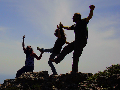
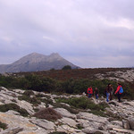
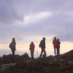
Where do these new young girls come from? 🙄 To be honest, I feel the urge to assemble and post a 2nd part of «Who in The Where» only for their sake! Maybe I will do it later, for example in January or February, when I will have missed summer. Now I have stick to my schedule and to do the last of «Landscapes of others». Only that, to pay respect to the new trend, I have chosen landscapes which are not empty. Ladies and gentlemen, dear readers of my humble blog, please welcome 13 landscape shots celebrating the wild nature of Ikaria, 13 landscape shots which somewhere in their many pixels include beautiful human figures! In one of them I am included too, that was when I was young and wild enough to match the natural surroundings. Let’s see if you can spot me ![]()
Here we go! Go little poeple in the landscape!
Go Ikaria! ⭐ ⭐ ⭐
.


 17 by angeloska, on Flickr")


 by angelos ka, on Flickr")

 by angelos ka, on Flickr")


You were bored because you have seen these pictures already?
I promise, my next post will be more original!
Follow me up! ![]()
Eleni Ik
❤
Wednesday, September 30, 2015
These Mountains are for Yoga!
Δημοσιεύθηκε: 30 Αυγούστου, 2015 Filed under: choses vécues, exploring, hiking, ikaria, photography, pleasure, travel | Tags: adventure, aegean, asanas, atheras, beach, enviro-lore, fitness, girls, Greece, hiking, ikaria, instagram, island in the aegean sea, Αιγαίο, Δάσος Ράντη, ικαρία, μονοπάτια, mountain, nature-culture, out of the beaten path, people in landscape, people-landscape, performance, philosophy, photo rapsody, Radi, The EGG, tourism, Xenia, yoga, yoga postures 6 Σχόλια- .

……………………………………...


.


__
.
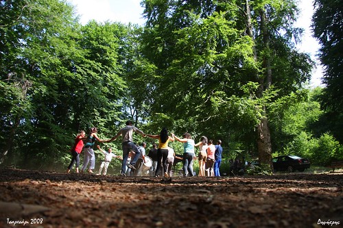
. . Please forgive my ignorance if I made one or two mistakes in giving the sanskit names of the different yoga postures. I thought the terms of that magical old language connect well to the original spiritual meaning of the exercises. The title of the entry is a tribute to the unforgettable «These Mountains Are For Dancing», a brilliant performance on the mountains of Ikaria by OPS Ikarias in 2014.
Tuesday, September 1, 2014
Two big hikes Google mapped!
Δημοσιεύθηκε: 28 Φεβρουαρίου, 2015 Filed under: choses vécues, exploring, hiking, ikaria, photography, travel | Tags: adventure, aegean, angels' pools, atheras, ecotourism, empty-landscapes, forest, Google maps, Greece, highlights, hiking, hiking trails, ikaria, Δάσος Ράντη, ικαρία, μονοπάτια, June, map, naked, OPS Ikarias, out of the beaten path, photography, Radi, Ratsos, tourism, Upper Chalares 5 Σχόλια.

One’s own country is the country where one does not need a map, even less a Google map with coordinates, to go around. But Ikaria is not your country so maybe you do. As a matter of fact, I think you do. Our little island is very complicated and if you have a doubt just go and browse through my «landscapes of others» set of illustrated entries. I’d rather see people walking these landscapes, instead of those disastrous goats, therefore, besides my explorers, I hold in great esteem the people who make maps and share them with the world, evenmore, when these people go for originality, have good taste and stay away from clichés. ![]()
As you have assumed, since my last entry about the «Ikaria Guidebook», I have changed course, and have taken on to the practical side of things. Let’s say, how about hiking safely in the famous but little known, ancient Forest of Radi? How about going in the depths of the upper part of Chalares canyon to find waterfalls and pools to swim naked? 😉
Don’t worry about crowds, ’cause the articles that I will suggest speak about places only for the few. And I would be surprised if you met even few. Take my word, I have been in both these places several times and in spite their breathtaking wild beauty, I never met a living soul!
Although Ikaria has all the assets to become an AAA mountain and outdoor destination, nobody on the island seems to care to know what to do about it so things are left to chance. Taking everything into account, it doesn’t matter. With the exception of the short tourist boom of August, we are and, as it seems, we will always be an island for the few – the few hunters of adventure in a wild and exciting unknown! 😎
But even hunters of adventure need help sometimes…
.
The first Google mapped hiking route I would like to present to you today was created by the local Mountain Climbing &’ Hiking Association (OPS Ikarias) and it is about a circular hike in the Forest of Radi which lies between the village of Petropouli in Messaria and the village of Frantato in Perameria. Their blog can be easily translated through Google translate, so here is what they say in the announcement of the completion of this hiking route:
«Hello Readers! After many hiking trips and searches which ended in defining a circular route in Radi Forest, our Hiking Club proudly presents the digital map: «The Round of Radi Forest»!»
They have indeed made many trips and searches and their Google map the best evidence. This document contains 70 pins with coordinates along an intricate trail of more than 12 kilometers, most of them inside a thick forest, as well as 145 photos! If not for anything but only to appreciate the ammount of their work I think it’s worthwhile to zoom in to make a virtual walk from pin to pin and browse through the pictures. What a feat! But as they said when I asked, that magical forest was worth it!
If you click on the image below you will be transported to the OPS Ikarias website where you can read/translate their entry. At the end there is a list of advice and instructions which you may find useful before you do this hike.

…..
And now, after thick mysterious woods, let’s speak about rocks, sun and river water. Do you remember our friend Zdeněk Šenkyřík, the Czech photographer who I praised in my blog last July? Well, Zdeněk recently revisited his material from Ikaria as well as other islands and reorganized everything into something that I would call «Do it like Zdeněk!»

…..
…..
Introducing his chapter about Ikaria Zdeněk says:
«In 2014 while we were planning our trip to Samos, we made a small change to visit Ikaria as well. We wanted to get to know this paradise for lovers of wild nature – canyons, waterfalls, mountain hikes – awesome!»
 Indeed, once on the island last June he and his partner Petra were guided by the members of OPS Ikarias and they discovered several places of the kind they were looking for. A list of these spots which are so well shown in Zdeněk’s photos appears in a Google map inside the general page about Ikaria. But the best map and the best photos are included in the subchapter «Chalares Ikaria – swimming in waterfalls». Click on the image below to be transported to that page. We ❤ Zdeněk and Petra!
…..
…..

…..
……….
Still, before closing this, I have to advise everybody who found these hikes appealing to read again my forenote about the situation in Ikaria about hiking. To find and explore safely and succesfully the amazing forest of Radi or the wild and secluded upper part of Chalares canyon the best thing to do is to contact the members of OPS Ikarias, either at their blog which is open to comments or at their facebook page. Like they did with the Czech friends, not only they will be willing to help but they will also have other interesting suggestions according to your likes and the time of the year.
…..
Eleni Ik ❤
Saturday February 28, 2015


")


")


Πρόσφατα σχόλια