
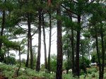
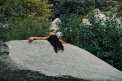
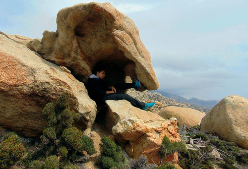
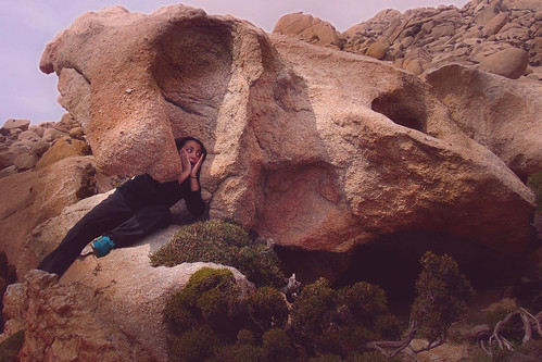
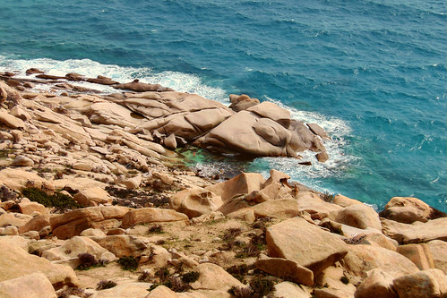
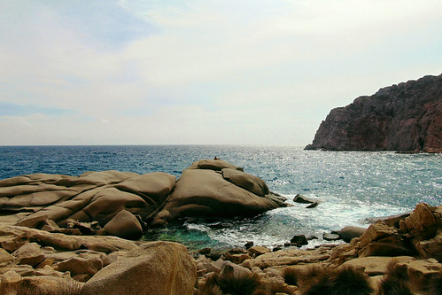
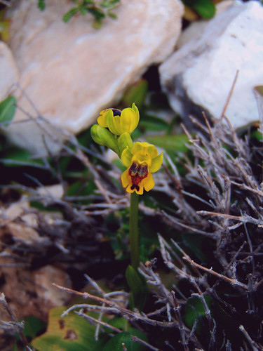
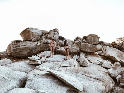
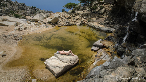
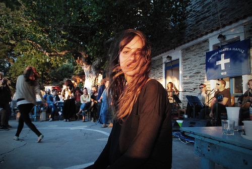
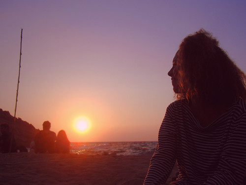
Bare backs in Ikaria
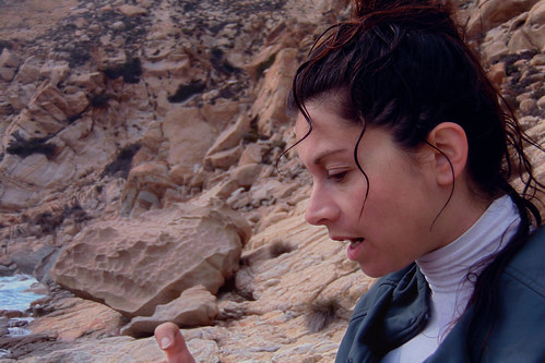
Δημοσιεύθηκε: 20 Οκτωβρίου, 2022 Filed under: choses vécues, holidays, ikaria, photography, pleasure, Uncategorized | Tags: aegean, backs, free expression, free the nipple, freedom, Greece, ikaria, instagram, Ικαρία, ελευθερία, nature, people in landscape, photography, summer, utopia, why-ikaria, woman Σχολιάστε«ἡ λησμονημένη εἶναι ἡ πλάτη ποὺ ἀνατρίχιασε»
Μιλτος Σαχτουρης
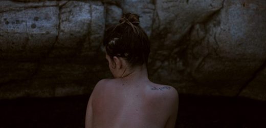
beautiful, womanly, free, hot, playful, sensual, glamorous, posey, mischievous, dreaming, pretentious, sweet, proud, artistic, expressive, liberated, integrated, unloaded, relieved, uncensored, natural, come clean, spill all, unburdened, unharnessed, sun-tanned, forgiving, set free, bountiful, giving, superficial, daring, safe, relaxed, challenging, summery, exposed to view, unclad, sheltered, feminine, all right


«happy moment without harness and saddle»😉.

Just enjoy viewing.
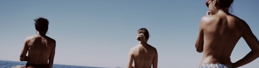
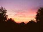
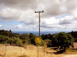
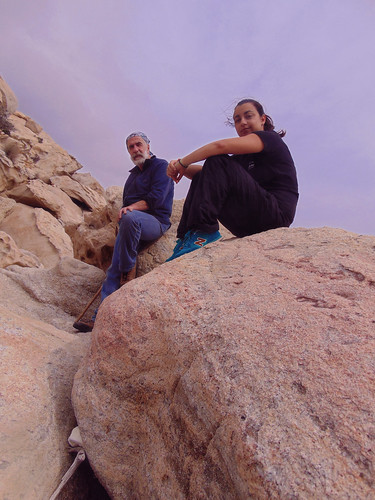
 Hard winter ahead…
Eleni ♥️♥️♥️

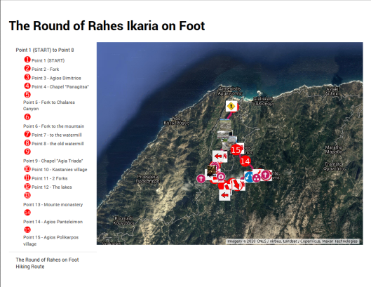
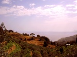
The Round of Rahes on Foot 👣
Δημοσιεύθηκε: 8 Μαΐου, 2020 Filed under: choses vécues, exploring, hiking, holidays, ikaria, pleasure, travel, Uncategorized | Tags: aegean, covid-19, Google maps, Greece, greeks-in-crisis, hiking map, hiking trails, ikaria, χάρτης μονοπατιών, Ικαρία, Ο Γύρος των Ραχών με τα Πόδια, μονοπάτια, Mountain Climbing and Hiking Association of Ikaria, OPS Ikarias, self-guided hiking, The Round of Rahes on Foot, tourism 11 Σχόλια.
Dear readers
As our lockdown in Greece was about to end last week the boys were listening to the Greek Deputy Minister for Sports, Lefteris Avgenakis on TV. He was saying that due to the health crisis all major sports events (read, football) are cancelled. The boys were very sad over this so I turned and paid attention. The Minister of Great God Football concluded his announcement with these words:
«It is certain that the crisis of the pandemic we are experiencing has created opportunities. This fact makes us very happy. We continue in the direction of promoting our health and I invite you to look for forms of alternative sports and to discover the joy of these activities and the endless beauty of our country».
I was really startled! I had never expected a Sports Minister of a Mediterranean country to suggest hiking instead of football!
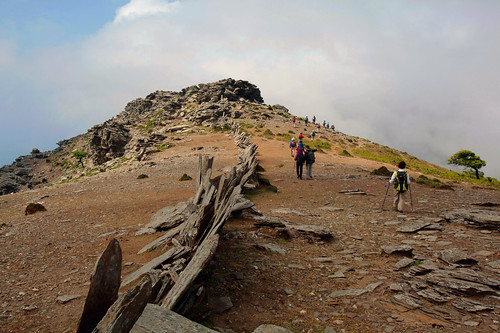
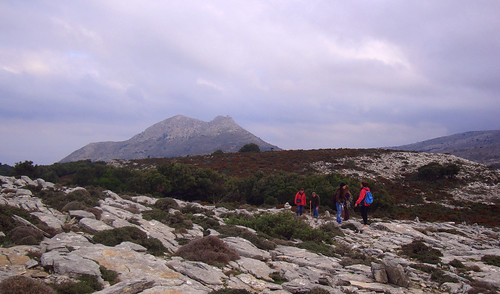
Consequently, I see myself as perfectly complying with the government request as I am writing this article about hiking. It is, of course, about hiking in Ikaria and in particular, about hiking on one of the oldest and best hiking trails on my island, the «The Round of Rahes on Foot», a natural and cultural heritage trail created about 20 years ago which was just recently worked afresh by the members of the local hiking club OPS Ikarias.
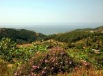
This famed hike starts very near Armenistis. This village is the main tourist town of the island, therefore the Round, unlike the other distant hikes on the mountains, was designed as an easy self-guided sightseeing walk for plain tourists – not necessarily 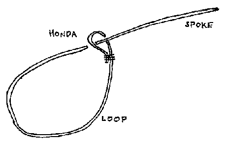 experienced hikers. The plan of the Round is like a lasso with the hiker walking first on the spoke to the honda and then following the loop rightwards back to the honda and on the spoke again to go back to Armenistis. The spoke streches along the ravine of the river Charakas for 2-3 km but after the honda the loop rises away from the river and cruises around Rahes properly speaking, through terraced fields, gardens, olive groves and pine woods, on narrow stony trails, village lanes and modern motor roads across village squares, until the peak of the hike (Point 12 on the map), the beautiful mountainous landscape at the two small lakes «Mikro Fragma» (alt. 500 m.) and the Monastery «Evangelistria Mounte», two perfect spots for resting and maybe deciding instead of going back on the Round to try one of the three long trails which start right in that area…
But what am I doing? You can read everything about Rahes and the Round of Rahes in the fact sheet attached to 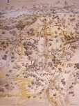 the digital map of the hike. Both of these very helpful documents are in English, with texts and captions based on the historical, printed edition of the Round issued in Greek nearly two decades ago. The new map, besides sights, important locations and countless photos, also includes the spots where the Round meets some very insteresting distant hikes, such as «The Trail in Chalares Canyon», «The Trail of Atheras Ridge», «The Trail in Myrsonas» and «The Trail of the Elves».
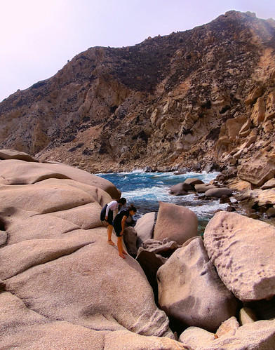
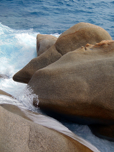
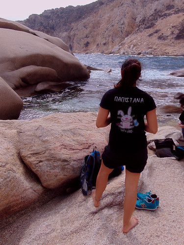
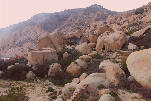
When in Ikaria, either you are a visitor or a resident, I advise you to follow this trail inside a mountain/island landscape, typical of the Mediterranean, yet carrying a peculiar tint which both estranges and befriends. It’s placid and in the same time it’s wild like… well, like m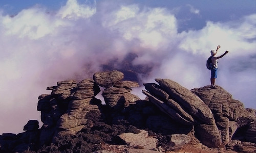 e! So, I am naming today the Round of Rahes on Foot as The 8th Power Spot in Ikaria! Let these few photos below, taken by me in that area a long time ago, stand as enough evidence. Thanks!
😘
.
.

NOTE 1: Large sustainable tourism projects like this don’t just happen by magic. At the end of their article about their work on this trail the makers express their gratitude to «Amikaria» and «Friends of Ikaria», two associations who have offered a lot to the project. Big thanks from me too!
 NOTE 2: Although the Round is 14 km long, we are talking about an easy to medium hike never running too far away from inhabited areas. Even if so, however, the lovers of adventure in the complicated landscape of Rahes will surely find several secret spots to enjoy nature in private.
Believe me, we know! 😉 😋
Seven Power Spots in Ikaria
Δημοσιεύθηκε: 4 Δεκεμβρίου, 2018 Filed under: choses vécues, exploring, hiking, holidays, ikaria, pleasure, travel, Uncategorized | Tags: adventure, aegean, atheras, eleni-in-ikaria, explorers, Google maps, Greece, hiking, hiking map, hiking trails, ikaria, χάρτης, Ορειβατικός Πεζοπορικός Σύλλογος Ικαρίας, ΟΠΣ Ικαρίας, ικαρία, μονοπάτια, Mountain Climbing and Hiking Association of Ikaria, my-friends, OPS Ikarias, self-guided hiking 12 Σχόλια.
Hello readers!
The Sturmvogel 💗
said «Soul Powered Works»!
And I say now «Seven Power Spots»!!!
It’s wintertime and summer is a long way ahead, so let’s forget «narcinstagram» 🙂 for a while and get down to serious business. Because here I am going to catch the pending threads from Nana’s glorious old article «Hiking routes…» and weave some more cloth on the loom.
 Skip the metaphors…
This article is actually about the work of Hiking Club of Ikaria in mapmaking! Let me quote Nana’s words about these people…
«In spite the lack of support by government and privates, OPS Ikarias are doing more than their best to promote hiking in Ikaria. In the course of time they have literally built with their hands a large network of very popular hiking routes in the island’s varied landscapes and since 2014 when they owned a page in Google they started making Google maps of some of these hikes. Though I have helped several times, it is never enough. There is and there will always be plenty more to do.»
«This entry stands as a due tribute, promotion and encouragement to their effort. As I said and as surprising as this can be, the OPS Ikarias are not funded by anybody. On the other hand, as far as marking and mapping the paths are concerned, given that they are very few and that the terrain of the island is very rough and complicated, they haven’t done badly at all!»
«However, their task is far from being concluded. The maps that I am presenting below to do not correspond to organized, marked and clearly secure trails of the kind we see in other parts of the world. So very often advise and guidance in needed in advance. But the good thing is that the OPS Ikarias are residents who live on the island all year long. So, before you take up any of these hikes, I am asking you to get in contact with them either through their Google page, blog, photo gallery on Flickr and group on facebook.»

And I, how am I involved? Well, I was the naive and ignorant newcomer who put a few red marks on this map of Ikaria and posted it on my blog back in 2006. It became so popular so fast on the net that I felt awkard and had to take it down (Nana, our good archiver, stored it though). You see, although I have done a lot in this direction, I wouldn’t take it on me to draw maps of my island, thus offering reliable guidance across its exciting but rough, exhausting and sometimes dangerous landscapes.
 These times are over! Since that old red marker stained sheet of paper, we have had fine quality digital mapmaking on the net, interactive, with a signature, and for free, created by OPS Ikarias for the sake of hiking, nature, tradition, pleasure and sport. There is so much love into this things that I have decided to call the places included in these maps -places where they have dedicated so much time and work (Soul Powered Work!)– I have decided to call them «Power Spots»!
How many are they until now? 1, 2, 3, 4, 5, 6, 7 !!!
So here they are, dear readers, nature lovers and possible future hikers of Ikaria, the Seven Power Spots of the island, checked, signed, branded and… blogged!
 Love
Love
Eleni
your faithful weaver
. 💗’
.
1) The Lighthouse of Kavo Papas
Check the OPS Ikarias review of the location
About the trail, check the OPS Ikarias map:
«Karkinagri – Kavo Papas»
and the amazing photos included in my article:
«A Day at an Exhibition»
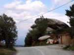
2) «Σπιτάκι της Μαμής»
Check the OPS Ikarias review of the location
and my article: «The little house in the desert»
3) Δάσος Ράντη
See also my richly illustrated article:
«Legends about Ikaria: The Forest of Radi»
«The Round of Radi Forest on Foot»
(See also their review of the location)
4) ΛΑΓΚΑΔΑ
[♦] See the location on the map and read
the OPS Ikarias review loaded with many recent photos.
[♦] See the map & description of the 1st hiking route in the area:
«HINTERLAND»
A hiking round in the wild mountains of western Ikaria
Also in the OPSI blog: «HINTERLAND»,
γύρος στην ορεινή ενδοχώρα της δυτικής Ικαρίας.
[♦] See the map & description of the 2nd hiking route in the area:
«On the old dry stone built trails of Northwestern Ikaria»
Mavrianou – Vrakades – Langada – Amalou
5) Crossing Mt Atheras from north to south
With a stop for a meal in Taverna Plaka».
[Read the OPS Ikarias review of this place]
Map of the hike:
«Karavostamo – Dokimi – Arethousa – Chrysostomo»
Photos:
«Karavostamo – Dokimi – Arethousa – Chrysostomo»
The Pictures!!!
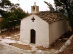
6) Chalares Canyon
[♦] The beautiful area and the old chapel of «Ai Giannis»,
also the epicenter of the «Musical Yards» events in July.
[♦] Read the OPS Ikarias review
about the trail in the Canyon.
[♦] Finally, for the experienced, the bold and the demanding:
«The Round of Upper Chalares Canyon»
7) Μονοπάτι του Αθέρα
[♦] This amazing long trail running on Ikaria’s high mountain ridge starts from the Tower of Drakano. Read the OPS Ikarias review of the place and check out the location on the map.
[♦] About the trail read the OPS Ikarias review
and check out the starting point.
[♦] Finally, the map of the first part of this hike. It’s one of the best I’ve seen on Google maps! I so hope OPS Ikarias will continue with this project!
«THE TRAIL OF ATHERAS RIDGE»
.
Related articles in my blog:


.
⭐ ⭐ ⭐
Finally, don’t miss to buy the new hiking map of Ikaria by ANAVASI EDITIONS!
All of these locations and trails are included, and even more, most of which offered gratis by the Ikarian Hiking Club!
Ikaria, Greece
Tuesday, December 4, 2018
Updated
Monday 29, August 2022
….
Keep it till next summer 😎
Δημοσιεύθηκε: 7 Σεπτεμβρίου, 2018 Filed under: choses vécues, exploring, festivals, hiking, holidays, ikaria, music, photography, pleasure, stories, travel, Uncategorized | Tags: adventures, aegean, August, blog review, boys, camping-in-ikaria, free culture, freedom, fun, girls, Greeks, greeks-in-crisis, hiking trails, ikaria, ikarians, instagram, ικαρία, μονοπάτια, love, millennials, portraits, rocks, seasonal hippies, stories, summer, summer 2018, swimming, travel, why-ikaria, wild camping, wild swimming, wildshots, young 2 Σχόλια……
Corpus Arcanarum Ikariae in Augustum
……
«Παμε γερα με τσαμπουκα.»
(Greek slogan)
……
☀☀☀☀☀☀☀☀☀☀☀☀☀☀☀☀☀
Hello readers!
This is not a reblog. This is a roundup!
😊 😊 😊

Ikaria, August 2018
«Αγαπώ τον Αύγουστο στην Ικαρία. Βλέπεις κι ακούς πολλά. Δείχνεις κι εσύ και λες πολλά. Ο Αύγουστος είναι μια γιορτή. Για κριτική κι ανάλυση θα έχουμε μπόλικο χρόνο το χειμώνα.»
[«Νύχτα παπί τρικάβαλο»]
[Σχόλια στο «Νύχτα παπί τρικάβαλο»]
Ikaria, August 2017
«Be hip and with the youths»
[«Be hip and with the youths»]
[Σχόλια στο «Be hip and with the youths»]
Ikaria, August 2017
«Οι νέοι της Ελλάδας αρνούνται να αφήσουν τη χειρότερη οικονομική κρίση στην ιστορία της Ευρωπαϊκής Ένωσης να τους στερήσει το δικαίωμα στην απόλαυση του γενέθλιου τόπου τους.»
[«Απόδραση απ’ την Κρίση»]
[Σχόλια στο «Απόδραση απ’ την Κρίση»]
Ikaria, August 2017
«Έτσι πέρασε κι αυτός ο Αύγουστος στην ΑντιΜύκονο…»
[«Ήταν ένας Αύγουστος με πολλά λινκς»]
[Σχόλια στο «Ήταν ένας Αύγουστος με πολλά λινκς»]
Ikaria, August 2017
«Now, don’t think I have betrayed Flickr but as it goes, from the side of Ikaria at least, sometimes the pictures fail in edge, spontaneity and personal touch. for the small picture, the snapshot, the ephemeral, subjective thing, Instagram, coming with all its smart filters and tricks, seems to win the game.»
[«Adventures, Fun & Attitude: Selected grams from Ikaria ♥ Part 1»]
[Comments on «Adventures, Fun & Attitude: Selected grams from Ikaria ♥ Part 1»]
Ikaria, August 2017
«It’s the story of the young travellers to Ikaria in the summer. It’s all loaded on Instagram. Enjoy and respect. This is the new DIY generation who are not looking for ready-made things but for the true experience, for whatever that takes.»
[«Adventures, Fun & Attitude: Selected grams from Ikaria ♥ Part 2»]
[Comments on «Adventures, Fun & Attitude: Selected grams from Ikaria ♥ Part 2»]
Ikaria, August 2017
«Was it I the other woman alone? The woman alone who was looked at by another woman alone in that cut-off place and moment? Yes, perhaps it was I. I turned fifty last year. And as often as always I like to swim in remote, quiet places at dusk.»
[«Adventures, Fun & Attitude: Selected grams from Ikaria ♥ Part 3 ➕»]
[Comments on «Adventures, Fun & Attitude: Selected grams from Ikaria ♥ Part 3 ➕»]
…………………….
So here is the latest bunch.⭐ ⭐ ⭐ ⭐
Note: All of the photos displayed below were chosen after long search according to complicated criteria. None of them have been downloaded but embedded into this post directly from the source. If you click on the thumbnails, you will be directed to the originals on Instagram.
All rights reserved by the respective owners © 2017-2018
.
.
![]()


…

……
Yesterday is today,
today is tomorrow.
So long
and take care
Eleni ❤
……
…
…
…
…
…
Διαβάστε τη συνέχεια του άρθρου »
Adventures, Fun & Attitude: Selected grams from Ikaria ♥ Part 3 ➕
Δημοσιεύθηκε: 8 Απριλίου, 2018 Filed under: choses vécues, exploring, festivals, hiking, holidays, ikaria, photography, pleasure, stories, travel, Uncategorized | Tags: adventure, adventures, aegean, August, beach, blog review, camping, dreams, Greece, hiking, hiking trails, ikaria, ikariagram, ikarians, instagram, ικαρία, μονοπάτια, literature, my life, photostory, portraits, rahes, stories, summer 2017, Trapalou, travel 8 Σχόλια……
❀ ❀ ❀ ❀ ❀ ❀ ❀ ❀ ❀ ❀ ❀ ❀ ❀ ❀ ❀ ❀ ❀
Hello readers!
This is obviously the third part of the second part and the first part. But in this post there is a big [[➕]]! Because as I was browsing through Instagram to choose some last pictures from Ikaria to show you, I looked again at a picture I had added in PART 1 and I realised that it wasn’t just one random holiday snaphot. More pictures followed and all of them belonged to a story – a story written in a blog!
But first things first. Take a look at my last 50 selected grams from Ikaria and then scroll down to read my English translation of Virginia’s «Sobre una mujer sola en una playa». As you will see in the end, I have reasons to cherish very strong personal feelings about it. But far besides that, what matters more is that I find her adventure and more importantly the way she describes her adventure the best to this moment, most edgy and wonderfully dramatic example of the attitude I’ve spoken about in Part 2:
«Enjoy and respect. This is the new DIY generation who are not looking for ready-made things but for the true experience, for whatever that takes.»
……………………..⭐ ⭐ ⭐ ⭐
Note: I have displayed the pictures randomly and democratically all same size. None of them (including the ones inside the Virginia’s story) have been downloaded but embedded into this post directly from the source. All rights reserved by the respective owners © 2012-2017
.
.


![]()


…
«Sobre una mujer sola en una playa»
(About a woman alone on a beach)
«Later that evening, we were sitting there and I could hear a church bell from the Orthodox church around the corner. My ear followed the sound there and back, there and back, my eye trailing the distance to the church in the dark. I asked my aunt if she was awake. She stirred in her chair and said yes, she was. I said, how did you make it so long. She asked what I meant. I said, there are so many years. How can you be alone so long. She said she didn’t know.»
[Jesse Ball, How to Make a Fire and Why]

«Last year with Adrián we decided to take a trip. He asked me where I wanted to go, and I told him that for some time I had in my thoughts the island of Ikaría. He wondered why. I do not know, I told him. He asked me again: what is there? Nothing, I said. It is an island where there is nothing. He told me, that’s an answer.»
«He asked me again: what is there? Nothing, I said. It is an island where there is nothing. He told me, that’s an answer.»

«There was a turning point in the trip and it was the day of the monopati. By then I already had severely infected soles of the feet. I think about the precise moment, a few days before, in which the blisters that almost completely covered the metatarsals broke and I still get goosebumps. I remember it with my head but I also remember it more with my body, it was a burning like I had never felt before, I felt it break, tear. And if walking most of the day with a heavy backpack on my back, sleeping little and feeding mainly on the figs and grapes that we found on the way, it was already difficult, every step I took with the blisters open and beginning to become infected was a torture.»

«There was a turning point in the trip and it was the day of the monopati.»
«We spent the night in a forest on the outskirts of Raches and the next morning we started walking very early. In the course of the day we had to descend an altitude of nine hundred meters extended along twenty kilometers by mountain road and reach the coastal town of Karkinagri, at the south-western end of the island. We had no choice. Between Raches and Karkinagri there was absolutely nothing, no food, no water, no shelter, no firm terrain to camp, only a narrow monopati that descended sinuously and abruptly down the mountain.»

«The first challenge was to find the mentioned monopati. The map of Ikaría that we had pointed out as villages what we, upon arriving, discovered that they were only scattered houses, many of them abandoned (one night we camped inside one, it was the night that I really thought I was going to die, that until then everything had arrived, but that is another story).»

«After walking for a few hours we arrived at what we hoped would be a town, where we expected to replenish our water and ask for directions for the rest of the way, but all we found was a half-demolished farm in which a very old man milked a goat. He approached us with the wooden bucket full of warm, steaming, perfumed milk. The milk had a pregnant smell, cloying, a bit repulsive. I was dying to try it, I felt that my body was asking for it while the man told us that in his youth he had been a sailor and had been in Buenos Aires. French fries, he said in Spanish. His dogs barked at us with fury. We asked him about the monopati and he indicated where to go.»

«Later we heard voices and followed them and in the middle of the forest we found a neat land with an orchard and a house made of a container. Under a tree a group of men and women talked and worked. We asked them about the monopati and as Greeks as they were, they invited to come in, unconditional hospitality is practiced even in the depths of the forest, especially there (if a Greek refuses philoxenia to a stranger in the middle of the forest and there is no one to witness it, do the Erynias overwhelm him?). They served us a strong and delicious coffee (we had not had coffee for days, we had not done many things for days, like bathing) and they invited us with figs from their garden dried in the sun.»

«The owner of the house, about forty or forty-five years old, had grown tired of life in Athens and had exchanged it for that rectangle of land on which he lived most of the year, growing his own food and reading the classics, receiving friends during the summer. He was a serious man, serene, a man who spoke slowly, beautifully. The beautiful Greeks are truly beautiful, slender and proud, with marked features and deep wrinkles of expression. Beside him, Adrian, with his blond curls and his upturned nose and his reckless speech, looked like a teenager.»

«We continue advancing and at the highest point of the mountain, in the middle of a thorny forest, an enchanted forest, the most beautiful I saw, we found a tiny church and sitting at the door a shaggy man, the caretaker. Hour after hour and day after day he would sit there, alone, in silence. We asked him about the monopati. He showed us the way. He himself is walking up and down on it every several weeks to get provisions from the town. We were reassured by this concrete reference that the monopati existed and it was not far away.»

«Finally we found it and the descent was slow and difficult. My feet were in deplorable condition, I felt the stockings alternately wet and stiff, as blood and pus sprouted and dried. We walked slower and slower, and Adrian became impatient. He advanced alone and he waited for me later, feeling solicitous and confused. We got lost several times. The monopati at times became so narrow that it was easy to mistake it with openings that appeared naturally among the vegetation. Several times we took the wrong direction. We opened and closed gates. We climbed trees and stones. We crossed a dry river in a valley.»
«It had been a difficult day for two people who knew little of each other, who began to glimpse with a mixture of rejection and compassion into the miseries of the other and to remember their own miseries, those that one tends to forget when there is no witness around, when conveniences and routines camouflage them a bit.»

«Around four in the afternoon we arrived at the town. We hated it immediately. Ikaría does not receive too many tourists, but the few that were there were there. We ate something quickly and decided to continue on our way and spend the night in [Manganitis], a nearby town. We resumed the march in silence. It had been a difficult day for two people who knew little of each other, who began to glimpse with a mixture of rejection and compassion into the miseries of the other and to remember their own miseries, those that one tends to forget when there is no witness around, when conveniences and routines camouflage them a bit.»

«We arrived at [Manganitis] at sunset, and the place was a dream. A tiny village, quiet, no more than fifteen houses. A warm tavern in the shade of a vine. A bay of white stones, turquoise waters. A small church and a cemetery near the edge of the sea (where we would spend the night, sleeping in one of the mausoleums between candles and coffins, but that’s another story). A group of men and women swam naked. Adrian also undressed and got into the water. I sat on the still warm stones of the shore and soaked my feet. The salt water washed my blood and the pain worsened first and then it started to ease up a bit. The group of bathers left and the beach was deserted.»

«It was almost dark when a woman in her fifties appeared. Adrian had swum away, and we seemed to be alone on that silent beach at the end of the world. She took off her clothes and got into the water. She swam for a long time and then came back to the shore and wrapped herself in a towel and stayed there, looking at the water until it was completely dark. Then she got dressed, took her things and left.»

«All this preamble is to say that last night I thought about that woman. Many times, I think about that woman, and last night was one of those times. I was in bed and was cold (because the days are warm and sunny, but still cool at night) and I began to rub my arms and legs with my hands to warm me up. And I do not know why that gesture made me suddenly feel very aware that I am alone. That I brought myself to this bed in the house of strangers in a city in another hemisphere and I am responsible for giving me heat, I am both the injured foot and the salty sea that heals, the woman alone and the woman alone who looks at the woman alone.»
TEXT: ΤΡΕΙΣ ΜΗΝΕΣ: «Sobre una mujer sola en una playa»
PICTURES: Virginia Rech on Instagram

** «Monopati» («μονοπάτι» in Greek) = footpath, a more or less narrow trail usually across nature or rural land.
*** There is a slight confusion with placenames. To all evidence the final scene of the story takes place in «Trapalou» instead of «Manganitis» which is a relatively large village located much further to the east.
……
AFTERWORD:
Was it I the other woman alone? The woman alone who was looked at by another woman alone in that cut-off place and moment? Yes, perhaps it was I. I turned fifty last year. And as often as always I like to swim in remote, quiet places at dusk. Thank you Virginia. All Virginias of this world, thank you!!!
So long and take care
Eleni ❤
……
Adventures, Fun & Attitude: Selected grams from Ikaria ♥ Part 2
Δημοσιεύθηκε: 19 Νοεμβρίου, 2017 Filed under: choses vécues, festivals, holidays, ikaria, photography, pleasure, stories, travel, Uncategorized | Tags: adventure, aegean, August, beach, free culture, free expression, freedom camping, GenDIY, good-conspiracy, Greece, greeks-in-crisis, grouvaloi, hiking, ikaria, instagram, ικαρία, millennials, photography, portraits, seasonal hippies, stories, summer 2017, transitions, travel, vanity, why-ikaria 13 Σχόλια……
❀ ❀ ❀ ❀ ❀ ❀ ❀ ❀ ❀ ❀ ❀ ❀ ❀ ❀ ❀ ❀ ❀
Hello readers!
This is the second part of… well, the first part. How these two successive posts came about is a long Greek story. It’s the story of the young travellers to Ikaria in the summer. It’s all loaded on Instagram. Enjoy and respect. This is the new DIY generation who are not looking for ready-made things but for the true experience, for whatever that takes.
I have displayed the pictures randomly and democratically all same size, but I can allow myself to say that my favorite is a portrait of a sweet young woman with a caption in Greek, which means:
«When you are hungry but still pose»
……………………..⭐ ⭐ ⭐ ⭐
Note: None of the 100 pictures seen below have been downloaded but embedded into this post directly from the source. All rights reserved by the respective owners © 2012-2017
.
.


…
……

Finally, the last picture: that was taken by Georgia, a local photographer last February. I n the previous post Nana said I like to connect with the past. This is only partly true. I connect with the past and the past connects with me. That girl there looks as if it was me standing on that spot when I took this historical picture long long long ago, back in November 2005!!!
So long and take care
Eleni ❤
……
Adventures, Fun & Attitude: Selected grams from Ikaria ♥ Part 1
Δημοσιεύθηκε: 19 Νοεμβρίου, 2017 Filed under: choses vécues, exploring, festivals, holidays, ikaria, photography, pleasure, stories, travel, Uncategorized | Tags: adventure, aegean, August, beach, free culture, free expression, GenDIY, Greece, greeks-in-crisis, ikaria, instagram, ικαρία, millennials, photography, portraits, seasonal hippies, stories, transitions, travel, vanity 14 Σχόλια……
❀ ❀ ❀ ❀ ❀ ❀ ❀ ❀ ❀ ❀ ❀ ❀ ❀ ❀ ❀ ❀ ❀
Hello readers!
Now, don’t think I have betrayed Flickr but as it goes, from the side of Ikaria at least, sometimes the pictures fail in edge, spontaneity and personal touch. It’s no wonder my friends lately don’t add pictures from Flickr in their comments on my posts. They seem to prefer Instagram and I think they are right. Flickr is fine for the large picture and it’s jaw-dropping what you can sometimes see in there, but for the small picture, the snapshot, the ephemeral, subjective thing, Instagram, coming with all its smart filters and tricks, seems to win the game. No wonder (again) why it’s so popular with the under 30s. And these under 30s are the ones who flock together and liven up Ikaria in the summer. Are you guessing it already? You guessed right. Forget the introduction. This article is not really about photography. It’s about these under 30s. Cheers to their generation! All the spirit I love and cherish, they got it! And certainly a lot more!
Go, go, go, young travelers to Ikaria in the age of crisis!
……………………..⭐ ⭐ ⭐ ⭐
Note: None of the 100 pictures seen below have been downloaded but embedded into this post directly from the source. All rights reserved by the respective owners © 2012-2017
.


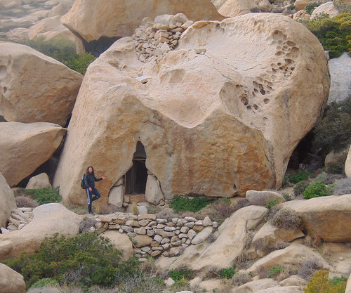
The little house in the desert
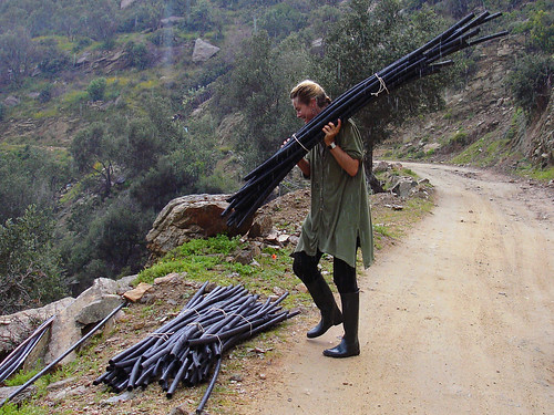
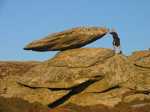
Δημοσιεύθηκε: 10 Ιουνίου, 2017 Filed under: choses vécues, hiking, holidays, ikaria, photography, pleasure, stories, travel, Uncategorized | Tags: adventures, Aegean Sea, atheras, balancing rocks, Google maps, Greece, heritage, hiking, ikaria, ikarians, Κίνηση Πολιτών Ραχών Ικαρίας, Ορεινό Καταφύγιο, εθελοντές, ικαρία, μονοπάτια, mountain shelter, my life, OPS Ikarias, tradition, volunteers 14 Σχόλια.
………The place ![]()
………⭐ ⭐ ⭐
On the wuthering heights of mount Atheraς in the center of a sandy plateau surrounded by windswept round boulders lies a tiny cube-like building with a chimney on its flat roof. This is «To Spitaki tis Mamis» (the little house of the midwife), or «Saint Panteleimon Mountain Refuge», as the marble plate in the wall next to the door says. Built by a kind woman in 1960 for the benefit of all mountain walkers, Spitaki tis Mamis, despite its miniature size, is a mountain shelter properly speaking, not associated to a church or mountain chapel, as it is usual in Greece, but built hiking-wise at important crossroads in a location where a hiker cannot possibly miss. This makes Spitaki tis Mamis, if not the oldest, undoubtedly one of the oldest mountain shelters in the Aegean islands. With my own ears I have heard about the lives it has saved through the years. On the chimney there was a fog bell to guide lost souls in the mountain and inside, as if by a magic hand, it was always provided with firewood, cooking pots, lamps and lamp oil, coffee, sugar, rice etc.
It was a place that wrote history.
However and in spite of all that, in the course of events and new road building in the 1990s Spitaki tis Mamis was forgotten and fell in oblivion. As a result, today -57 years after it was built- it’s in very bad shape: cracked walls, no door and window and a roof almost ready to fall in.
………The project ![]()
………⭐ ⭐ ⭐
Last month, answering 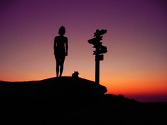 to a request made by several local associations, Spitaki tis Mamis was declared by the Town Council as a cultural monument – standing reminder of the times when there were no roads and cars in Ikaria and the only way to travel from one part of the island to another was by walking long hours across uninhabited, mountainous landscapes in rain, snow or fog. Following this desicion, the Town Council granted permission to the interested parts to repair the old shelter and adapt it to modern needs. As they said, that would be done on the own expences and voluntary work without help from either central or local government…
Volunteers going to work in the wilderness on dream project…?
Oops! I know that! I must help!
………My involvement ![]()
………⭐ ⭐ ⭐
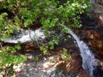
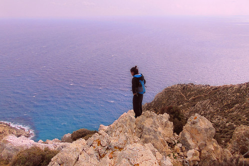
Dear readers, the purpose  of this article is to advertise the aforementioned project and call for funding and support. To do so I can’t find a better way than to show you a set of 16 photos taken many years ago on a hike along half the length of the mountain ridge. That great, mind and soul filling, two-day trip would not have been possible if Spitaki tis Mamis didn’t exist.
In the middle of that desert of rocks, sands, ferns and srubs, although abandonned and broken, it was still there marking the way, connecting the present with the past. It still said «Hello, I am here for you». I want it to be repaired. If not for any other reason, because of an experience I will never forget. Many years ago when I was single and young, while lying in my sleeping bag on its old cracked concrete roof, still warm from the sun,  I gazed at the biggest and brightest summer night sky I’ve seen in my life!
……… The pictures ![]()
………⭐ ⭐ ⭐
.

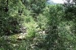
On the path inside Ranti Forest
…..

Walking on the ridge and leaving the old forest behind
…..

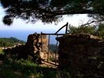
A typical Ikarian rock house on the way to Rahes
…..

Checking the map in the sunset. Got to reach that mountain shelter before nightfall
…..

Unpacking inside the tiny mountain shelter
…..

The fireplace!
…..

Sunrise on Ammoudia plateau, alt. 860 m.
…..


On the road inside Erifi plateau in the morning
…..

In view of forested uplands
…..

Hike across barren wastelands
…..

In view of the southern coast at last
…..

Walking down to Karkinagri on a beautiful stone paved lane for a while
…..

Old houses built on steep ground in the historical part of the village next to a very violent mountain torrent
…..

…..
That was all from me for now. You can read the official account of the project at this link. For donations, as well as for extra hands, you may write to opsikarias2008@gmail.com and/or kinisi.politon.ikaria@gmail.com. I will keep you up to date for further developments.
Follow me up! ![]()
Eleni Ik ❤
…..
Saturday, June 6, 2017
A Day at an Exhibition
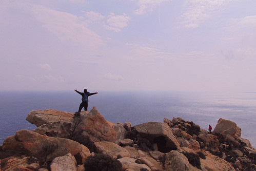
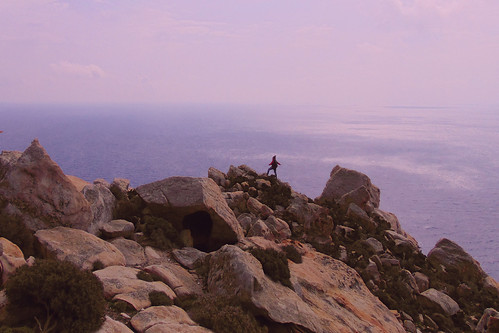
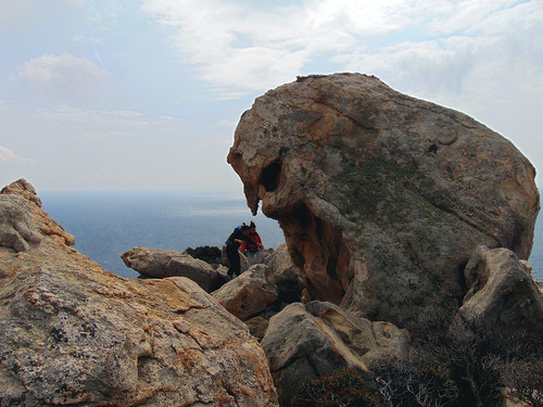
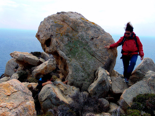
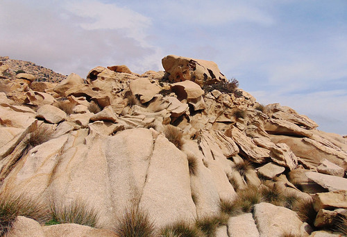
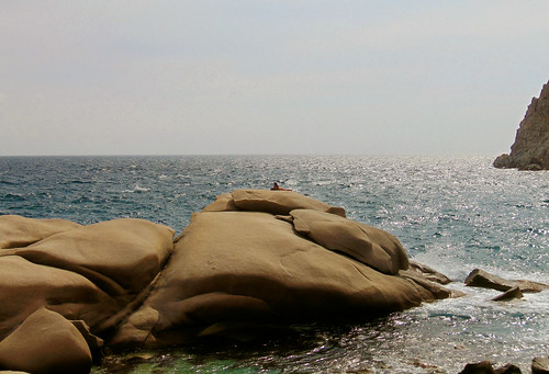
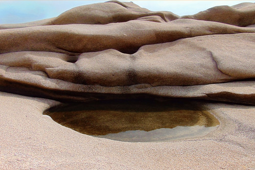
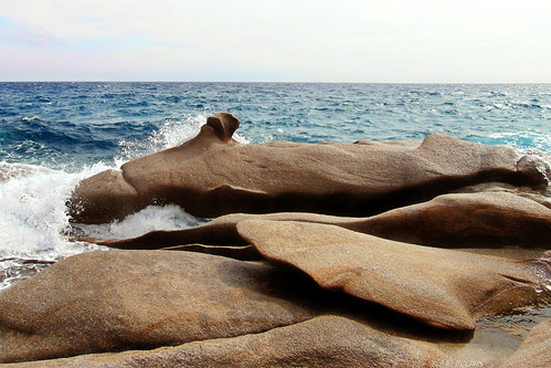
Δημοσιεύθηκε: 26 Μαρτίου, 2017 Filed under: choses vécues, exploring, hiking, holidays, ikaria, photography, pleasure, stories, travel, Uncategorized | Tags: adventure, aegean, angelos, art, explorers, flickr, Google maps, Greece, hiking, hiking trails, ikaria, χάρτης, Κάβο Πάπας, Ορειβατικός Πεζοπορικός Σύλλογος Ικαρίας, ΟΠΣ Ικαρίας, ικαρία, μονοπάτια, landscape, landscapes of others, map, March, Mavri, my-work, OPS Ikarias, photography, rocks, wild swimming 14 Σχόλια- .
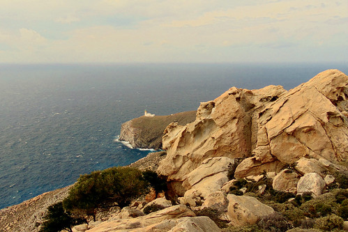
Dear readers💗As things are at my work I sometimes have to stay for hours at nerve-racking standbys. To relax tension the trick is always to turn my mind to Ikaria and then to look for something interesting to blog about my island. In most cases things don’t fall in as I wish. Inspiration is a bird in flight, but sometimes there are exceptions.😋
 Last week during one of those standbys I mentionned above, and while I was surfing fruitlessly in Flickr, I looked for new stuff from friends and a wonderful new set of 29 pictures from Ikaria appeared in front of my eyes: «A Day at an Exhibition» – «Hard hiking, wild swimming and admiring rocks scuptured by nature in Cape Papas, Ikaria». What a brilliant title, description and of course, visual content!These pictures were taken by my friend Angelos, amateur photographer and leading member of the Ikarian hiking club, on a day of March while he and his friends were trying to find a trail through «a jungle of rocks sculptured by nature» (sic) to connect the remote village of Karkinagri with the even remoter westernmost tip of Ikaria and the historical, spectacular lighthouse which stands on it.... ⭐ ⭐ ⭐ ...As you could see in this great map above, the trail was found! Therefore, I think we should expect to see more shots from this colorful and naturally artistic, wild coast of Ikaria very soon. But for the time being, these are the best I have seen. I am letting you enjoy them! Move your mouse over the thumbnails to read a few words written by the author about each picture. They are very expressive and enlightening!..
All pictures © Mountain Climbing & Hiking Club of Ikaria


. .
 .
.
Côte de Naufragés Sauvés
Thank you very much, Angelos and
the other friends from OPS Ikarias!💗
Sunday, March 26, 2017
Picture Calendar 2017! 😎
Δημοσιεύθηκε: 12 Ιανουαρίου, 2017 Filed under: choses vécues, festivals, flying, hiking, holidays, ikaria, photography, pleasure, stories, travel, Uncategorized | Tags: adventure, aegean, calendar, flickr, Greece, hiking, hiking trails, icaria, ikaria, ikaria-in-winter, island in the aegean sea, χειμώνας, ικαρία, μονοπάτια, layers, merominia, my-friends, OPS Ikarias, photography, things to know, up-with-lonely-winter, winter 8 Σχόλια Dear readers,
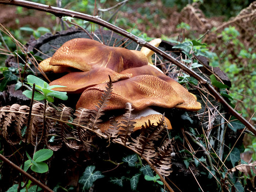
in Ikaria almost every village, community or association makes a picture calendar for the new year to raise money for various causes and needs. Competition is tough so these calendars are getting better and better in both concept and context every year. Take for example this one by the Ikarian Radio Station on the subject of mushrooms. (By the way, do you remember my post about Ikarian mushrooms?)
Anyway, I am not a village, that’s obvious! And my purpose is not to raise money either. I am one of the co-founders and co-administrators of a small photo community about Ikaria on Flickr and there we have the same tradition as on the island itself: every year we produce a Picture Calendar! The idea behind it is not money of course. All I want is to present some pictures which, besides their quality, are worth to be seen by anyone who is interested in our small stripe of land. They are pictures typical of the corresponding months and/or typical of what goes on in Ikaria during these months.
This year too I made a Calendar for the group, but as I said in the forenote, this time the choice of photos would not be mine. They would be either the viewers’ choice through Flickr  or merely at random through
The only bit of choosing I did was to pick a photo as a sample from the first rows of both websites. The reason was that as we scroll down the pages, the pictures tend to be less and less relevant to the topic, that is «Flickr + location + month».
I hope you will enjoy this. The larger pictures on the left direct to Flickr. The smaller pictures on the right direct to Google. Click and watch our Ikarian monthly panorama!
Happy New Year!


🍁 🍁 🍁 🍁 🍁 🍁


")


")


Πρόσφατα σχόλια